
 Przasnysz
Gliwice
Stoczek Łukowski
Janów
Legnica
Krzeszowice
Szczytno
Koszalin
Kielce
Gdańsk
Poznań
Warsaw
Pruszków
Przasnysz
Gliwice
Stoczek Łukowski
Janów
Legnica
Krzeszowice
Szczytno
Koszalin
Kielce
Gdańsk
Poznań
Warsaw
Pruszków
Elblag on the map, Poland
Where is located Elblag
Exact location — Elblag, Elbląg, Warmian-Masurian Voivodeship, Poland, marked on the map with a red marker.
Coordinates
Elblag, Poland coordinates in decimal format: latitude — 54.1560613, longitude — 19.4044897. When converted to degrees, minutes, seconds Elblag has the following coordinates: 54°9′21.82 north latitude and 19°24′16.16 east longitude.
Population
Elblag, Elbląg, Warmian-Masurian Voivodeship, Poland, according to our data the population is — 127,558 residents, which is about 0.3% of the total population of the country (Poland).
Comparison of the population on the graph:
Exact time
Time zone for this location Elblag — UTC +2 Europe/Warsaw. Exact time — monday, 4 april 2024 year, 22 h. 39 minutes.
Sunrise and sunset
Elblag, sunrise and sunset data for a date — monday 29.04.2024.
| Sunrise | Sunset | Day (duration) |
|---|---|---|
| 05:12 -2 minutes | 20:06 +2 minutes | 14 h. 54 minutes. +4 minutes |
You can control the scale of the map using the auxiliary tools to find out exactly where it is located Elblag. When you change the scale of the map, the width of the ruler also changes (in kilometers and miles).
Nearby cities
The largest cities that are located nearby:
- Gdańsk — 53 km
- Gdynia — 69 km
- Olsztyn — 82 km
- Kaliningrad
 (Russia) — 94 km
 - Torun — 137 km
- Bydgoszcz — 147 km
- Wloclawek — 168 km
- Plock — 179 km
- Klaipėda
 (Lithuania) — 203 km
 - Koszalin — 209 km
- Poznań — 256 km
- Łódź — 265 km
- Bialystok — 274 km
- Kalisz — 279 km
- Kaunas (Lithuania) — 298 km
- Šiauliai (Lithuania) — 312 km
- Gorzów Wielkopolski — 320 km
- Radom — 327 km
- Szczecin — 330 km
Distance to neighboring capitals:
- Vilnius (Lithuania) — 385 km
- Rīga
 (Latvia) — 429 km
 - Berlin
 (Germany) — 438 km
 - Copenhagen
 (Denmark) — 468 km
 - Minsk
 (Belarus) — 533 km
 - Prague
 (Czech Republic) — 566 km
 - Bratislava
 (Slovakia) — 687 km
 - Vienna
 (Austria) — 694 km
 - Budapest
 (Hungary) — 741 km
 - Helsinki
 (Finland) — 747 km
 - Kyiv
 (Ukraine) — 860 km
 - Amsterdam
 (Netherlands) — 984 km
 - Belgrade
 (Serbia) — 1045 km
 - Bern
 (Switzerland) — 1162 km
 - Moscow (Russia) — 1173 km
- Bucharest
 (Romania) — 1185 km
 - Paris
 (France) — 1315 km
 - Tbilisi
 (Georgia) — 2322 km
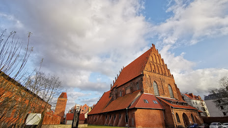
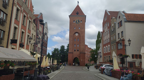
Attractions


Distance to the capital
Distance to the capital (Warsaw) is about — 240 km.