
 Annopol
Bialystok
Konin
Ostrow Wielkopolski
Kalisz
Olecko
Łaziska Górne
Częstochowa
Kwidzyn
Gorzów Wielkopolski
Katowice
Wrocław
Łódź
Piotrków Trybunalski
Elblag
Torun
Leszno
Tarnow
Kraków
Annopol
Bialystok
Konin
Ostrow Wielkopolski
Kalisz
Olecko
Łaziska Górne
Częstochowa
Kwidzyn
Gorzów Wielkopolski
Katowice
Wrocław
Łódź
Piotrków Trybunalski
Elblag
Torun
Leszno
Tarnow
Kraków
Legnica on the map, Poland
Where is located Legnica
Exact location — Legnica, Legnica County, Lower Silesian Voivodeship, Poland, marked on the map with a red marker.
Coordinates
Legnica, Poland coordinates in decimal format: latitude — 51.2070067, longitude — 16.1553231. When converted to degrees, minutes, seconds Legnica has the following coordinates: 51°12′25.22 north latitude and 16°9′19.16 east longitude.
Population
Legnica, Legnica County, Lower Silesian Voivodeship, Poland, according to our data the population is — 106,033 residents, which is about 0.3% of the total population of the country (Poland).
Comparison of the population on the graph:
Exact time
Time zone for this location Legnica — UTC +2 Europe/Warsaw. Exact time — friday, 4 april 2024 year, 22 h. 00 minutes.
Sunrise and sunset
Legnica, sunrise and sunset data for a date — friday 26.04.2024.
| Sunrise | Sunset | Day (duration) |
|---|---|---|
| 05:40 -2 minutes | 20:05 +1 minute | 14 h. 24 minutes. +3 minutes |
You can control the scale of the map using the auxiliary tools to find out exactly where it is located Legnica. When you change the scale of the map, the width of the ruler also changes (in kilometers and miles).
Nearby cities
The largest cities that are located nearby:
- Walbrzych — 48 km
- Wrocław — 62 km
- Zielona Gora — 92 km
- Opole — 137 km
- Cottbus
 (Germany) — 139 km
 - Poznań — 142 km
- Kalisz — 146 km
- Dresden (Germany) — 169 km
- Prague
 (Czech Republic) — 175 km
 - Gorzów Wielkopolski — 180 km
- Olomouc (Czech Republic) — 195 km
- Gliwice — 204 km
- Rybnik — 209 km
- Zabrze — 210 km
- Częstochowa — 212 km
- Ostrava (Czech Republic) — 215 km
- Bytom — 217 km
- Ruda Slaska — 218 km
- Chorzow — 222 km
Distance to neighboring capitals:
- Prague (Czech Republic) — 175 km
- Berlin (Germany) — 239 km
- Vienna
 (Austria) — 334 km
 - Bratislava
 (Slovakia) — 347 km
 - Budapest
 (Hungary) — 462 km
 - Copenhagen
 (Denmark) — 551 km
 - Vilnius
 (Lithuania) — 723 km
 - Belgrade
 (Serbia) — 782 km
 - Amsterdam
 (Netherlands) — 785 km
 - Bern
 (Switzerland) — 791 km
 - Rīga
 (Latvia) — 822 km
 - Minsk
 (Belarus) — 826 km
 - Kyiv
 (Ukraine) — 1011 km
 - Paris
 (France) — 1019 km
 - Bucharest
 (Romania) — 1057 km
 - Helsinki
 (Finland) — 1137 km
 - Moscow
 (Russia) — 1501 km
 - Tbilisi
 (Georgia) — 2413 km
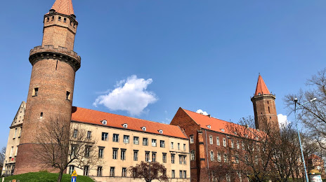
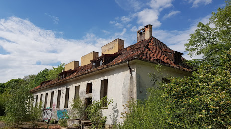
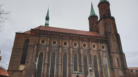
Attractions


Distance to the capital
Distance to the capital (Warsaw) is about — 353 km.