
 Józefów nad Wisłą
Gorzyce Wielkie
Rogówek
Sromowce Niżne
Wyszków County
Kruszewo
Jantar
Sady Górne
Nagoszewo
Józefów nad Wisłą
Gorzyce Wielkie
Rogówek
Sromowce Niżne
Wyszków County
Kruszewo
Jantar
Sady Górne
Nagoszewo
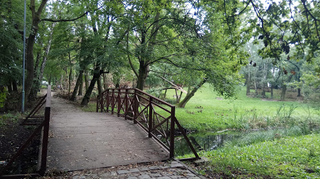
The City Park. General Władysława Andersa on the map, Gniezno, Poland
Photo
Where is located The City Park. General Władysława Andersa
The City Park. General Władysława Andersa — local attraction, which is located at aleja Marcinkowskiego 1A, 62-200 Gniezno, Poland and belongs to the category — park. Average visitor rating for this place — 4.3 (according to 451 rating, information from open sources and relevant for 2022).
Exact location — The City Park. General Władysława Andersa, marked on the map with a red marker.
You can get directions to The City Park. General Władysława Andersa on the map from your location.
What else is interesting in Gniezno? You can see all the sights if you go to the city page.
Coordinates
The City Park. General Władysława Andersa, Poland coordinates in decimal format: latitude — 52.534107048661916, longitude — 17.610671298174474. When converted to degrees, minutes, seconds The City Park. General Władysława Andersa has the following coordinates: 52°32′2.79 north latitude and 17°36′38.42 east longitude.
Nearby cities
The largest cities that are located nearby:
- Poznań — 47 km
- Bydgoszcz — 71 km
- Torun — 86 km
- Kalisz — 92 km
- Wloclawek — 100 km
- Plock — 143 km
- Łódź — 154 km
- Zielona Gora — 156 km
- Gorzów Wielkopolski — 159 km
- Wrocław — 162 km
- Legnica — 177 km
- Koszalin — 205 km
- Opole — 207 km
- Gdańsk — 212 km
- Walbrzych — 214 km
- Elblag — 215 km
- Częstochowa — 219 km
- Szczecin — 223 km
- Gdynia — 228 km
Distance to the capital
Distance to the capital (Warsaw) is about — 233 km.