
 Józefów nad Wisłą
Gorzyce Wielkie
Rogówek
Sromowce Niżne
Wyszków County
Kruszewo
Jantar
Sady Górne
Nagoszewo
Józefów nad Wisłą
Gorzyce Wielkie
Rogówek
Sromowce Niżne
Wyszków County
Kruszewo
Jantar
Sady Górne
Nagoszewo
Port Rybacki on the map, Kolobrzeg, Poland
Photo
Where is located Port Rybacki
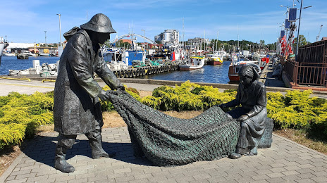
Port Rybacki — local attraction, which is located at Szyprów 12, 78-100 Kołobrzeg, Poland and belongs to the category — fishing pier. Average visitor rating for this place — 4.5 (according to 422 ratings, information from open sources and relevant for 2022).
Exact location — Port Rybacki, marked on the map with a red marker.
You can get directions to Port Rybacki on the map from your location.
What else is interesting in Kolobrzeg? You can see all the sights if you go to the city page.
Coordinates
Port Rybacki, Poland coordinates in decimal format: latitude — 54.18510155411441, longitude — 15.55324129800347. When converted to degrees, minutes, seconds Port Rybacki has the following coordinates: 54°11′6.37 north latitude and 15°33′11.67 east longitude.
Nearby cities
The largest cities that are located nearby:
- Koszalin — 38 km
- Szczecin — 107 km
- Gorzów Wielkopolski — 161 km
- Gdynia — 193 km
- Gdańsk — 198 km
- Bydgoszcz — 199 km
- Poznań — 216 km
- Malmö
 (Sweden) — 226 km
 - Rostock
 (Germany) — 226 km
 - Berlin (Germany) — 235 km
- Berlin (Germany) — 237 km
- Torun — 238 km
- Elblag — 247 km
- Zielona Gora — 248 km
- Copenhagen
 (Denmark) — 251 km
 - Potsdam (Germany) — 260 km
- Cottbus (Germany) — 281 km
- Wloclawek — 288 km
- Kalisz — 317 km
Distance to the capital
Distance to the capital (Warsaw) is about — 424 km.