
 Józefów nad Wisłą
Gorzyce Wielkie
Rogówek
Sromowce Niżne
Wyszków County
Kruszewo
Jantar
Sady Górne
Nagoszewo
Józefów nad Wisłą
Gorzyce Wielkie
Rogówek
Sromowce Niżne
Wyszków County
Kruszewo
Jantar
Sady Górne
Nagoszewo
Muzeum Regionalne im. K. Klepackiego on the map, Krotoszyn, Poland
Photo
Where is located Muzeum Regionalne im. K. Klepackiego
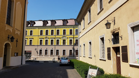
Muzeum Regionalne im. K. Klepackiego — local attraction, which is located at Mały Rynek 1, 63-700 Krotoszyn, Poland and belongs to the category — museum. Average visitor rating for this place — 4.5 (according to 32 ratings, information from open sources and relevant for 2022).
Exact location — Muzeum Regionalne im. K. Klepackiego, marked on the map with a red marker.
You can get directions to Muzeum Regionalne im. K. Klepackiego on the map from your location.
What else is interesting in Krotoszyn? You can see all the sights if you go to the city page.
Coordinates
Muzeum Regionalne im. K. Klepackiego, Poland coordinates in decimal format: latitude — 51.695949657349566, longitude — 17.43506969830184. When converted to degrees, minutes, seconds Muzeum Regionalne im. K. Klepackiego has the following coordinates: 51°41′45.42 north latitude and 17°26′6.25 east longitude.
Nearby cities
The largest cities that are located nearby:
- Kalisz — 45 km
- Wrocław — 71 km
- Poznań — 86 km
- Legnica — 104 km
- Opole — 118 km
- Walbrzych — 129 km
- Zielona Gora — 134 km
- Łódź — 138 km
- Wloclawek — 152 km
- Częstochowa — 153 km
- Bydgoszcz — 162 km
- Torun — 165 km
- Gliwice — 178 km
- Zabrze — 179 km
- Plock — 179 km
- Bytom — 182 km
- Gorzów Wielkopolski — 187 km
- Chorzow — 188 km
- Ruda Slaska — 188 km
Distance to the capital
Distance to the capital (Warsaw) is about — 252 km.