
 Gilserberg
Berlin
Bordesholm
Bechtolsheim
Aub
Triptis
Heppenheim
Biblis
Angermünde
Gilserberg
Berlin
Bordesholm
Bechtolsheim
Aub
Triptis
Heppenheim
Biblis
Angermünde
Zittau Municipal Museums on the map, Zittau, Germany
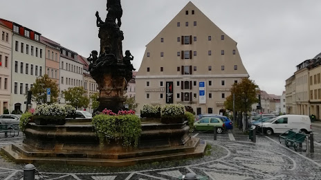
Photo
Where is located Zittau Municipal Museums
Zittau Municipal Museums — local attraction, which is located at Klosterstraße 3, 02763 Zittau, Germany and belongs to the category — museum. Average visitor rating for this place — 4.6 (according to 198 ratings, information from open sources and relevant for 2022).
Exact location — Zittau Municipal Museums, marked on the map with a red marker.
You can get directions to Zittau Municipal Museums on the map from your location.
What else is interesting in Zittau? You can see all the sights if you go to the city page.
Coordinates
Zittau Municipal Museums, Germany coordinates in decimal format: latitude — 50.89813899697072, longitude — 14.808409998272621. When converted to degrees, minutes, seconds Zittau Municipal Museums has the following coordinates: 50°53′53.3 north latitude and 14°48′30.28 east longitude.
Nearby cities
The largest cities that are located nearby:
- Dresden — 76 km
- Prague
 (Czech Republic) — 95 km
 - Legnica
 (Poland) — 100 km
 - Cottbus — 100 km
- Walbrzych (Poland) — 104 km
- Zielona Gora (Poland) — 124 km
- Chemnitz — 132 km
- Wrocław (Poland) — 157 km
- Pilsen (Czech Republic) — 164 km
- Leipzig — 175 km
- Gera — 190 km
- Berlin — 201 km
- Potsdam — 202 km
- Gorzów Wielkopolski (Poland) — 205 km
- Poznań (Poland) — 220 km
- Opole (Poland) — 220 km
- Olomouc (Czech Republic) — 227 km
- Brno (Czech Republic) — 229 km
- Kalisz (Poland) — 244 km
Distance to the capital
Distance to the capital (Berlin) is about — 205 km.