
 Józefów nad Wisłą
Gorzyce Wielkie
Rogówek
Sromowce Niżne
Wyszków County
Kruszewo
Jantar
Sady Górne
Nagoszewo
Józefów nad Wisłą
Gorzyce Wielkie
Rogówek
Sromowce Niżne
Wyszków County
Kruszewo
Jantar
Sady Górne
Nagoszewo
Muzeum 2. Pułku Szwoleżerów Rokitniańskich on the map, Starogard Gdański, Poland
Photo
Where is located Muzeum 2. Pułku Szwoleżerów Rokitniańskich
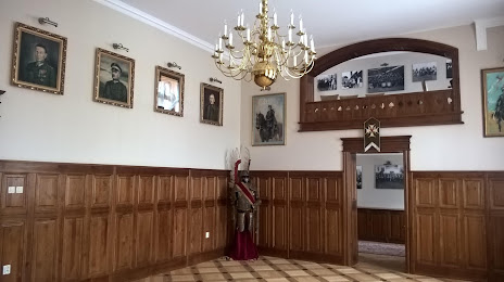
Muzeum 2. Pułku Szwoleżerów Rokitniańskich — local attraction, which is located at Jana III Sobieskiego 14, 83-200 Starogard Gdański, Poland and belongs to the category — museum. Average visitor rating for this place — 4.4 (according to 34 ratings, information from open sources and relevant for 2022).
Exact location — Muzeum 2. Pułku Szwoleżerów Rokitniańskich, marked on the map with a red marker.
You can get directions to Muzeum 2. Pułku Szwoleżerów Rokitniańskich on the map from your location.
What else is interesting in Starogard Gdański? You can see all the sights if you go to the city page.
Coordinates
Muzeum 2. Pułku Szwoleżerów Rokitniańskich, Poland coordinates in decimal format: latitude — 53.96653142352258, longitude — 18.534998198228433. When converted to degrees, minutes, seconds Muzeum 2. Pułku Szwoleżerów Rokitniańskich has the following coordinates: 53°57′59.51 north latitude and 18°32′5.99 east longitude.
Nearby cities
The largest cities that are located nearby:
- Gdańsk — 44 km
- Gdynia — 61 km
- Elblag — 61 km
- Bydgoszcz — 99 km
- Torun — 105 km
- Olsztyn — 130 km
- Wloclawek — 150 km
- Kaliningrad
 (Russia) — 152 km
 - Koszalin — 154 km
- Plock — 176 km
- Poznań — 203 km
- Kalisz — 245 km
- Łódź — 252 km
- Klaipėda
 (Lithuania) — 252 km
 - Gorzów Wielkopolski — 258 km
- Szczecin — 268 km
- Zielona Gora — 304 km
- Bialystok — 322 km
- Wrocław — 332 km
Distance to the capital
Distance to the capital (Warsaw) is about — 254 km.