
 Józefów nad Wisłą
Gorzyce Wielkie
Rogówek
Sromowce Niżne
Wyszków County
Kruszewo
Jantar
Sady Górne
Nagoszewo
Józefów nad Wisłą
Gorzyce Wielkie
Rogówek
Sromowce Niżne
Wyszków County
Kruszewo
Jantar
Sady Górne
Nagoszewo
Regionalna Dyrekcja Lasów Państwowych w Pile on the map, Pila, Poland
Photo
Where is located Regionalna Dyrekcja Lasów Państwowych w Pile
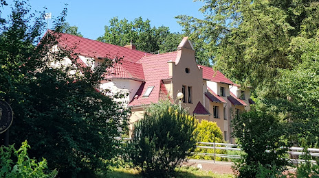
Regionalna Dyrekcja Lasów Państwowych w Pile — local attraction, which is located at 64-920, Poland and belongs to the category — national forest. Average visitor rating for this place — 4.7 (according to 53 ratings, information from open sources and relevant for 2022).
Exact location — Regionalna Dyrekcja Lasów Państwowych w Pile, marked on the map with a red marker.
You can get directions to Regionalna Dyrekcja Lasów Państwowych w Pile on the map from your location.
What else is interesting in Pila? You can see all the sights if you go to the city page.
Coordinates
Regionalna Dyrekcja Lasów Państwowych w Pile, Poland coordinates in decimal format: latitude — 53.10133587189043, longitude — 16.782624698195715. When converted to degrees, minutes, seconds Regionalna Dyrekcja Lasów Państwowych w Pile has the following coordinates: 53°6′4.81 north latitude and 16°46′57.45 east longitude.
Nearby cities
The largest cities that are located nearby:
- Poznań — 83 km
- Bydgoszcz — 84 km
- Gorzów Wielkopolski — 111 km
- Koszalin — 121 km
- Torun — 125 km
- Szczecin — 147 km
- Zielona Gora — 158 km
- Wloclawek — 166 km
- Kalisz — 179 km
- Gdańsk — 181 km
- Gdynia — 190 km
- Elblag — 205 km
- Plock — 210 km
- Legnica — 219 km
- Cottbus
 (Germany) — 226 km
 - Wrocław — 227 km
- Berlin (Germany) — 235 km
- Berlin (Germany) — 237 km
- Łódź — 241 km
Distance to the capital
Distance to the capital (Warsaw) is about — 301 km.