
 Iska-Chebakova
Tekstilshchik
Uray
Sestroretsk
Vychegodsky
Kotlas
Zuya
Iska-Chebakova
Tekstilshchik
Uray
Sestroretsk
Vychegodsky
Kotlas
Zuya  Bakhchysarai
Ridne
Pechory
Koltsovo
Kaspiysk
Pavlovsk
Miyagi
Bogorodskoye
Levikha
Pravdinskiy
Dobre
Sosnogorsk
Bakhchysarai
Ridne
Pechory
Koltsovo
Kaspiysk
Pavlovsk
Miyagi
Bogorodskoye
Levikha
Pravdinskiy
Dobre
Sosnogorsk
Leninsk-Kuznetskiy on the map, Russian Federation
Where is located Leninsk-Kuznetskiy
Exact location — Leninsk-Kuznetskiy, gorod Leninsk-Kuznetskiy, Kemerovo Oblast, Russia, marked on the map with a red marker.
Coordinates
Leninsk-Kuznetskiy, Russian Federation coordinates in decimal format: latitude — 54.6575, longitude — 86.161667. When converted to degrees, minutes, seconds Leninsk-Kuznetskiy has the following coordinates: 54°39′27 north latitude and 86°9′42 east longitude.
Population
Leninsk-Kuznetskiy, gorod Leninsk-Kuznetskiy, Kemerovo Oblast, Russia, according to our data the population is — 109,025 residents, which is about 0.1% of the total population of the country (Russian Federation).
Comparison of the population on the graph:
Exact time
Time zone for this location Leninsk-Kuznetskiy — UTC +7 Asia/Krasnoyarsk. Exact time — tuesday, 4 april 2024 year, 06 h. 01 minute.
Sunrise and sunset
Leninsk-Kuznetskiy, sunrise and sunset data for a date — tuesday 30.04.2024.
| Sunrise | Sunset | Day (duration) |
|---|---|---|
| 05:42 -2 minutes | 20:43 +2 minutes | 15 h. 0 minutes. +4 minutes |
You can control the scale of the map using the auxiliary tools to find out exactly where it is located Leninsk-Kuznetskiy. When you change the scale of the map, the width of the ruler also changes (in kilometers and miles).
Nearby cities
The largest cities that are located nearby:
- Prokopyevsk — 93 km
- Novokuznetsk — 117 km
- Mezhdurechensk — 164 km
- Novosibirsk — 208 km
- Barnaul — 214 km
- Tomsk — 216 km
- Seversk — 229 km
- Biysk — 243 km
- Achinsk — 319 km
- Abakan — 359 km
- Krasnoyarsk — 442 km
- Rubtsovsk — 487 km
- Oskemen
 (Kazakhstan) — 576 km
 - Kansk — 612 km
- Semey (Kazakhstan) — 627 km
- Kyzyl — 654 km
- Pavlodar (Kazakhstan) — 675 km
- Altay
 (China) — 767 km
 - Ekibastuz (Kazakhstan) — 811 km
Distance to neighboring capitals:
- Astana (Kazakhstan) — 1057 km
- Khan-Uul
 (Mongolian) — 1614 km
 - Beijing (China) — 2776 km
- Kathmandu
 (Nepal) — 2999 km
 - Tbilisi
 (Georgia) — 3327 km
 - Tehran
 (Iran) — 3388 km
 - Pyongyang
 (North Korea) — 3413 km
 - Yerevan
 (Armenia) — 3455 km
 - Helsinki
 (Finland) — 3582 km
 - Seoul
 (South Korea) — 3604 km
 - Tallinn
 (Estonia) — 3618 km
 - Kyiv
 (Ukraine) — 3692 km
 - Minsk
 (Belarus) — 3694 km
 - Rīga
 (Latvia) — 3753 km
 - Vilnius
 (Lithuania) — 3790 km
 - Mariehamn (Åland Islands) — 3846 km
- Stockholm
 (Sweden) — 3982 km
 - Hanoi
 (Vietnam) — 4089 km
 - Warsaw
 (Poland) — 4167 km
 - Oslo
 (Norway) — 4320 km
 - Bucharest
 (Romania) — 4338 km
 - Prague
 (Czech Republic) — 4683 km
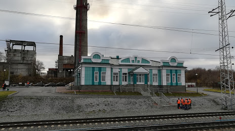
Attractions

Distance to the capital
Distance to the capital (Moscow) is about — 3020 km.