
 Józefów nad Wisłą
Gorzyce Wielkie
Rogówek
Sromowce Niżne
Wyszków County
Kruszewo
Jantar
Sady Górne
Nagoszewo
Józefów nad Wisłą
Gorzyce Wielkie
Rogówek
Sromowce Niżne
Wyszków County
Kruszewo
Jantar
Sady Górne
Nagoszewo
Jezioro Lemańskie on the map, Szczytno, Poland
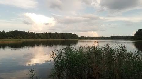
Photo
Where is located Jezioro Lemańskie
Jezioro Lemańskie — local attraction, which is located at no data and belongs to the category — -. Average visitor rating for this place — 4.4 (according to 55 ratings, information from open sources and relevant for 2022).
Exact location — Jezioro Lemańskie, marked on the map with a red marker.
You can get directions to Jezioro Lemańskie on the map from your location.
What else is interesting in Szczytno? You can see all the sights if you go to the city page.
Coordinates
Jezioro Lemańskie, Poland coordinates in decimal format: latitude — 53.56832029914664, longitude — 20.976648439482453. When converted to degrees, minutes, seconds Jezioro Lemańskie has the following coordinates: 53°34′5.95 north latitude and 20°58′35.93 east longitude.
Nearby cities
The largest cities that are located nearby:
- Olsztyn — 41 km
- Elblag — 122 km
- Kaliningrad
 (Russia) — 131 km
 - Plock — 142 km
- Bialystok — 152 km
- Wloclawek — 164 km
- Torun — 171 km
- Gdańsk — 175 km
- Gdynia — 190 km
- Bydgoszcz — 204 km
- Łódź — 226 km
- Kaunas
 (Lithuania) — 237 km
 - Klaipėda (Lithuania) — 237 km
- Radom — 239 km
- Brest
 (Belarus) — 247 km
 - Lublin — 278 km
- Kalisz — 281 km
- Šiauliai (Lithuania) — 299 km
- Kielce — 299 km
Distance to the capital
Distance to the capital (Warsaw) is about — 149 km.