
 Józefów nad Wisłą
Gorzyce Wielkie
Rogówek
Sromowce Niżne
Wyszków County
Kruszewo
Jantar
Sady Górne
Nagoszewo
Józefów nad Wisłą
Gorzyce Wielkie
Rogówek
Sromowce Niżne
Wyszków County
Kruszewo
Jantar
Sady Górne
Nagoszewo
Pątnowskie Lake on the map, Konin, Poland
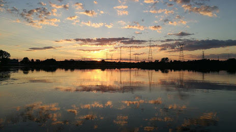
Photo
Where is located Pątnowskie Lake
Pątnowskie Lake — local attraction, which is located at 2.83 km² and belongs to the category — -. Average visitor rating for this place — 4.5 (according to 49 ratings, information from open sources and relevant for 2022).
Exact location — Pątnowskie Lake, marked on the map with a red marker.
You can get directions to Pątnowskie Lake on the map from your location.
What else is interesting in Konin? You can see all the sights if you go to the city page.
Coordinates
Pątnowskie Lake, Poland coordinates in decimal format: latitude — 52.307584915550116, longitude — 18.285022012746744. When converted to degrees, minutes, seconds Pątnowskie Lake has the following coordinates: 52°18′27.31 north latitude and 18°17′6.08 east longitude.
Nearby cities
The largest cities that are located nearby:
- Kalisz — 52 km
- Wloclawek — 72 km
- Torun — 90 km
- Poznań — 92 km
- Łódź — 97 km
- Bydgoszcz — 101 km
- Plock — 104 km
- Wrocław — 149 km
- Częstochowa — 167 km
- Opole — 173 km
- Legnica — 184 km
- Zielona Gora — 190 km
- Gorzów Wielkopolski — 210 km
- Walbrzych — 210 km
- Bytom — 212 km
- Zabrze — 213 km
- Gliwice — 215 km
- Chorzow — 219 km
- Radom — 219 km
Distance to the capital
Distance to the capital (Warsaw) is about — 186 km.