
 Józefów nad Wisłą
Gorzyce Wielkie
Rogówek
Sromowce Niżne
Wyszków County
Kruszewo
Jantar
Sady Górne
Nagoszewo
Józefów nad Wisłą
Gorzyce Wielkie
Rogówek
Sromowce Niżne
Wyszków County
Kruszewo
Jantar
Sady Górne
Nagoszewo
National Museum of Przemysl (Muzeum Narodowe Ziemi Przemyskiej) on the map, Przemyśl, Poland
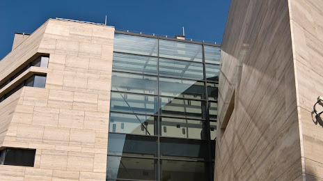
Photo
Where is located National Museum of Przemysl (Muzeum Narodowe Ziemi Przemyskiej)
National Museum of Przemysl (Muzeum Narodowe Ziemi Przemyskiej) — local attraction, which is located at Plac płk, Berka Joselewicza 1, 37-700 Przemyśl, Poland and belongs to the category — local history museum. Average visitor rating for this place — 4.6 (according to 611 ratings, information from open sources and relevant for 2022).
Exact location — National Museum of Przemysl (Muzeum Narodowe Ziemi Przemyskiej), marked on the map with a red marker.
You can get directions to National Museum of Przemysl (Muzeum Narodowe Ziemi Przemyskiej) on the map from your location.
What else is interesting in Przemyśl? You can see all the sights if you go to the city page.
Coordinates
National Museum of Przemysl (Muzeum Narodowe Ziemi Przemyskiej), Poland coordinates in decimal format: latitude — 49.783023805931215, longitude — 22.771721625256678. When converted to degrees, minutes, seconds National Museum of Przemysl (Muzeum Narodowe Ziemi Przemyskiej) has the following coordinates: 49°46′58.89 north latitude and 22°46′18.2 east longitude.
Nearby cities
The largest cities that are located nearby:
- Rzeszow — 62 km
- Tarnow — 129 km
- Uzhhorod
 (Ukraine) — 133 km
 - Košice
 (Slovakia) — 161 km
 - Lublin — 162 km
- Kielce — 191 km
- Kraków — 203 km
- Radom — 211 km
- Nyíregyháza
 (Hungary) — 217 km
 - Satu Mare
 (Romania) — 221 km
 - Miskolc (Hungary) — 238 km
- Baia Mare (Romania) — 242 km
- Dabrowa Gornicza — 259 km
- Rivne (Ukraine) — 261 km
- Debrecen (Hungary) — 263 km
- Brest
 (Belarus) — 264 km
 - Bielsko-Biala — 265 km
- Sosnowiec — 265 km
- Katowice — 270 km
Distance to the capital
Distance to the capital (Warsaw) is about — 299 km.