
 Józefów nad Wisłą
Gorzyce Wielkie
Rogówek
Sromowce Niżne
Wyszków County
Kruszewo
Jantar
Sady Górne
Nagoszewo
Józefów nad Wisłą
Gorzyce Wielkie
Rogówek
Sromowce Niżne
Wyszków County
Kruszewo
Jantar
Sady Górne
Nagoszewo
Muzeum Kresów i Ziemi Ostrowskiej on the map, Ostrow Mazowiecka, Poland
Photo
Where is located Muzeum Kresów i Ziemi Ostrowskiej
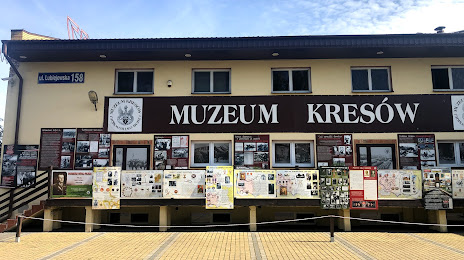
Muzeum Kresów i Ziemi Ostrowskiej — local attraction, which is located at Lubiejewska 158, 07-300 Ostrów Mazowiecka, Poland and belongs to the category — museum. Average visitor rating for this place — 4.1 (according to 31 rating, information from open sources and relevant for 2022).
Exact location — Muzeum Kresów i Ziemi Ostrowskiej, marked on the map with a red marker.
You can get directions to Muzeum Kresów i Ziemi Ostrowskiej on the map from your location.
What else is interesting in Ostrow Mazowiecka? You can see all the sights if you go to the city page.
Coordinates
Muzeum Kresów i Ziemi Ostrowskiej, Poland coordinates in decimal format: latitude — 52.82784350867426, longitude — 21.880293425368432. When converted to degrees, minutes, seconds Muzeum Kresów i Ziemi Ostrowskiej has the following coordinates: 52°49′40.24 north latitude and 21°52′49.06 east longitude.
Nearby cities
The largest cities that are located nearby:
- Bialystok — 92 km
- Olsztyn — 142 km
- Brest
 (Belarus) — 147 km
 - Plock — 150 km
- Radom — 163 km
- Lublin — 178 km
- Wloclawek — 190 km
- Łódź — 203 km
- Elblag — 220 km
- Torun — 221 km
- Kaliningrad
 (Russia) — 229 km
 - Kielce — 232 km
- Bydgoszcz — 260 km
- Kaunas
 (Lithuania) — 265 km
 - Gdańsk — 271 km
- Baranovichi (Belarus) — 275 km
- Kalisz — 285 km
- Gdynia — 287 km
- Częstochowa — 293 km
Distance to the capital
Distance to the capital (Warsaw) is about — 89 km.