
 Inowroclaw
Olesno
Pleszew
Pelplin
Lubin
Mszczonow
Belchatow
Ilawa
Myslowice
Tczew
Sosnowiec
Knurów
Sucha Beskidzka
Żywiec
Nowy Targ
Stargard Szczecinski
Tarnobrzeg
Pila
Kęty
Inowroclaw
Olesno
Pleszew
Pelplin
Lubin
Mszczonow
Belchatow
Ilawa
Myslowice
Tczew
Sosnowiec
Knurów
Sucha Beskidzka
Żywiec
Nowy Targ
Stargard Szczecinski
Tarnobrzeg
Pila
Kęty
Ostrow Mazowiecka on the map, Poland
Where is located Ostrow Mazowiecka
Exact location — Ostrow Mazowiecka, Ostrów Mazowiecka County, Masovian Voivodeship, Poland, marked on the map with a red marker.
Coordinates
Ostrow Mazowiecka, Poland coordinates in decimal format: latitude — 52.8024372, longitude — 21.8950416. When converted to degrees, minutes, seconds Ostrow Mazowiecka has the following coordinates: 52°48′8.77 north latitude and 21°53′42.15 east longitude.
Population
Ostrow Mazowiecka, Ostrów Mazowiecka County, Masovian Voivodeship, Poland, according to our data the population is — 22,653 residents, which is about 0.1% of the total population of the country (Poland).
Comparison of the population on the graph:
Exact time
Time zone for this location Ostrow Mazowiecka — UTC +2 Europe/Warsaw. Exact time — saturday, 4 april 2024 year, 12 h. 04 minutes.
Sunrise and sunset
Ostrow Mazowiecka, sunrise and sunset data for a date — saturday 27.04.2024.
| Sunrise | Sunset | Day (duration) |
|---|---|---|
| 05:10 -3 minutes | 19:49 +2 minutes | 14 h. 42 minutes. +5 minutes |
You can control the scale of the map using the auxiliary tools to find out exactly where it is located Ostrow Mazowiecka. When you change the scale of the map, the width of the ruler also changes (in kilometers and miles).
Nearby cities
The largest cities that are located nearby:
- Bialystok — 92 km
- Olsztyn — 142 km
- Brest
 (Belarus) — 147 km
 - Plock — 150 km
- Radom — 163 km
- Lublin — 178 km
- Wloclawek — 190 km
- Łódź — 203 km
- Elblag — 220 km
- Torun — 221 km
- Kaliningrad
 (Russia) — 229 km
 - Kielce — 232 km
- Bydgoszcz — 260 km
- Kaunas
 (Lithuania) — 265 km
 - Gdańsk — 271 km
- Baranovichi (Belarus) — 275 km
- Kalisz — 285 km
- Gdynia — 287 km
- Częstochowa — 293 km
Distance to neighboring capitals:
- Vilnius (Lithuania) — 306 km
- Minsk (Belarus) — 396 km
- Rīga
 (Latvia) — 482 km
 - Berlin
 (Germany) — 573 km
 - Prague
 (Czech Republic) — 599 km
 - Bratislava
 (Slovakia) — 619 km
 - Budapest
 (Hungary) — 624 km
 - Vienna
 (Austria) — 643 km
 - Kyiv
 (Ukraine) — 650 km
 - Copenhagen
 (Denmark) — 685 km
 - Helsinki
 (Finland) — 841 km
 - Belgrade
 (Serbia) — 898 km
 - Bucharest
 (Romania) — 981 km
 - Moscow (Russia) — 1070 km
- Amsterdam
 (Netherlands) — 1147 km
 - Bern
 (Switzerland) — 1220 km
 - Paris
 (France) — 1436 km
 - Tbilisi
 (Georgia) — 2108 km
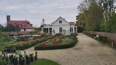
Attractions

Distance to the capital
Distance to the capital (Warsaw) is about — 87 km.