
 Gilserberg
Berlin
Bordesholm
Bechtolsheim
Aub
Triptis
Heppenheim
Biblis
Angermünde
Gilserberg
Berlin
Bordesholm
Bechtolsheim
Aub
Triptis
Heppenheim
Biblis
Angermünde
Kneipp Bad Worishofen on the map, Bad Wörishofen, Germany
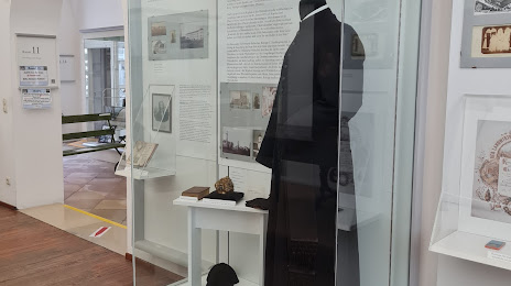
Photo
Where is located Kneipp Bad Worishofen
Kneipp Bad Worishofen — local attraction, which is located at Klosterhof 1, 86825 Bad Wörishofen, Germany and belongs to the category — museum. Average visitor rating for this place — 4.3 (according to 82 ratings, information from open sources and relevant for 2022).
Exact location — Kneipp Bad Worishofen, marked on the map with a red marker.
You can get directions to Kneipp Bad Worishofen on the map from your location.
What else is interesting in Bad Wörishofen? You can see all the sights if you go to the city page.
Coordinates
Kneipp Bad Worishofen, Germany coordinates in decimal format: latitude — 48.00320635997596, longitude — 10.589751946789907. When converted to degrees, minutes, seconds Kneipp Bad Worishofen has the following coordinates: 48°0′11.54 north latitude and 10°35′23.11 east longitude.
Nearby cities
The largest cities that are located nearby:
- Augsburg — 46 km
- Ulm — 62 km
- Munich — 74 km
- Innsbruck
 (Austria) — 102 km
 - Ingolstadt — 104 km
- Reutlingen — 116 km
- Stuttgart — 134 km
- Regensburg — 156 km
- Heilbronn — 161 km
- Nuremberg — 164 km
- Fürth — 165 km
- Zurich
 (Switzerland) — 169 km
 - Pforzheim — 169 km
- Erlangen — 178 km
- Salzburg (Austria) — 184 km
- Karlsruhe — 194 km
- Würzburg — 203 km
- Freiburg — 204 km
- Heidelberg — 207 km
Distance to the capital
Distance to the capital (Berlin) is about — 541 km.