
 Wissen
Barnstorf
Bodenwerder
Emmendingen
Lauben
Ober-Mörlen
Waldems
Suderburg
Wankum
Lohr a. Main
Petershagen
Au in der Hallertau
Sellin
Frankenfeld
Demmin
Zossen
Berthelsdorf
Bernau bei Berlin
Zeesen
Wissen
Barnstorf
Bodenwerder
Emmendingen
Lauben
Ober-Mörlen
Waldems
Suderburg
Wankum
Lohr a. Main
Petershagen
Au in der Hallertau
Sellin
Frankenfeld
Demmin
Zossen
Berthelsdorf
Bernau bei Berlin
Zeesen
Bad Wörishofen on the map, Germany
Where is located Bad Wörishofen
Exact location — Bad Wörishofen, Swabia, Bavaria, Germany, marked on the map with a red marker.
Coordinates
Bad Wörishofen, Germany coordinates in decimal format: latitude — 48.0051291, longitude — 10.5949358. When converted to degrees, minutes, seconds Bad Wörishofen has the following coordinates: 48°0′18.46 north latitude and 10°35′41.77 east longitude.
Population
Bad Wörishofen, Swabia, Bavaria, Germany, according to our data the population is — 13,922 residents, which is about 0% of the total population of the country (Germany).
Comparison of the population on the graph:
Exact time
Time zone for this location Bad Wörishofen — UTC +2 Europe/Berlin. Exact time — thursday, 5 may 2024 year, 13 h. 44 minutes.
Sunrise and sunset
Bad Wörishofen, sunrise and sunset data for a date — thursday 2.05.2024.
| Sunrise | Sunset | Day (duration) |
|---|---|---|
| 06:00 -2 minutes | 20:28 +1 minute | 14 h. 30 minutes. +3 minutes |
You can control the scale of the map using the auxiliary tools to find out exactly where it is located Bad Wörishofen. When you change the scale of the map, the width of the ruler also changes (in kilometers and miles).
Nearby cities
The largest cities that are located nearby:
- Augsburg — 46 km
- Ulm — 62 km
- Munich — 74 km
- Innsbruck
 (Austria) — 102 km
 - Ingolstadt — 104 km
- Reutlingen — 116 km
- Stuttgart — 134 km
- Regensburg — 156 km
- Heilbronn — 161 km
- Nuremberg — 164 km
- Fürth — 165 km
- Zurich
 (Switzerland) — 169 km
 - Pforzheim — 169 km
- Erlangen — 178 km
- Salzburg (Austria) — 184 km
- Karlsruhe — 194 km
- Würzburg — 203 km
- Freiburg — 204 km
- Heidelberg — 207 km
Distance to neighboring capitals:
- Vaduz
 (Liechtenstein) — 125 km
 - Bern (Switzerland) — 264 km
- Prague
 (Czech Republic) — 363 km
 - Ljubljana
 (Slovenia) — 367 km
 - Vienna (Austria) — 430 km
- Brussels
 (Belgium) — 551 km
 - Paris
 (France) — 615 km
 - Paris (France) — 615 km
- Amsterdam
 (Netherlands) — 632 km
 - Rome
 (Italy) — 695 km
 - Copenhagen
 (Denmark) — 864 km
 - Warsaw
 (Poland) — 878 km
 - Oslo
 (Norway) — 1325 km
 - Stockholm
 (Sweden) — 1345 km
 - Minsk
 (Belarus) — 1353 km
 - Kyiv
 (Ukraine) — 1468 km
 - Helsinki
 (Finland) — 1638 km
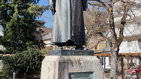
Attractions


Distance to the capital
Distance to the capital (Berlin) is about — 540 km.