
 Puerto de la Duquesa
La Serna de Iguña
Pumalverde
Puentenansa
La Iglesia
Casar de Periedo
Fuengirola
Renedo de Piélagos
Villabanez
Puerto de la Duquesa
La Serna de Iguña
Pumalverde
Puentenansa
La Iglesia
Casar de Periedo
Fuengirola
Renedo de Piélagos
Villabanez
Playa de Cerrillos on the map, Roquetas de Mar, Spain
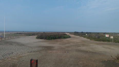
Photo
Where is located Playa de Cerrillos
Playa de Cerrillos — local attraction, which is located at no data and belongs to the category — -. Average visitor rating for this place — 3.7 (according to 15 ratings, information from open sources and relevant for 2022).
Exact location — Playa de Cerrillos, marked on the map with a red marker.
You can get directions to Playa de Cerrillos on the map from your location.
What else is interesting in Roquetas de Mar? You can see all the sights if you go to the city page.
Coordinates
Playa de Cerrillos, Spain coordinates in decimal format: latitude — 36.776036752124135, longitude — -2.6102407913863277. When converted to degrees, minutes, seconds Playa de Cerrillos has the following coordinates: 36°46′33.73 north latitude and -2°36′36.87 east longitude.
Nearby cities
The largest cities that are located nearby:
- Almería — 16 km
- Granada — 98 km
- Jaén — 152 km
- Málaga — 160 km
- Cartagena — 171 km
- Nador
 (Morocco) — 179 km
 - Murcia — 188 km
- Marbella — 203 km
- Oran
 (Algeria) — 213 km
 - Córdoba — 226 km
- Oujda (Morocco) — 238 km
- Tlemcen (Algeria) — 239 km
- Sidi Bel Abbes (Algeria) — 248 km
- Albacete — 255 km
- Algeciras — 263 km
- Tetouan (Morocco) — 281 km
- Dos Hermanas — 297 km
- Relizane (Algeria) — 306 km
- Taounate (Morocco) — 308 km
Distance to the capital
Distance to the capital (Madrid) is about — 416 km.