
 Puerto de la Duquesa
La Serna de Iguña
Pumalverde
Puentenansa
La Iglesia
Casar de Periedo
Fuengirola
Renedo de Piélagos
Villabanez
Puerto de la Duquesa
La Serna de Iguña
Pumalverde
Puentenansa
La Iglesia
Casar de Periedo
Fuengirola
Renedo de Piélagos
Villabanez
Illas de Gres on the map, A Estrada, Spain
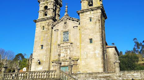
Photo
Where is located Illas de Gres
Illas de Gres — local attraction, which is located at no data and belongs to the category — -. Average visitor rating for this place — 4.4 (according to 92 ratings, information from open sources and relevant for 2022).
Exact location — Illas de Gres, marked on the map with a red marker.
You can get directions to Illas de Gres on the map from your location.
What else is interesting in A Estrada? You can see all the sights if you go to the city page.
Coordinates
Illas de Gres, Spain coordinates in decimal format: latitude — 42.78402184572168, longitude — -8.649886574980798. When converted to degrees, minutes, seconds Illas de Gres has the following coordinates: 42°47′2.48 north latitude and -8°38′59.59 east longitude.
Nearby cities
The largest cities that are located nearby:
- Vigo — 53 km
- Ourense — 64 km
- A Coruña — 75 km
- Braga
 (Portugal) — 127 km
 - Porto (Portugal) — 170 km
- Oviedo — 225 km
- León — 238 km
- Gijón — 245 km
- Coimbra (Portugal) — 275 km
- Salamanca — 303 km
- Valladolid — 332 km
- Santander — 385 km
- Burgos — 394 km
- Amadora (Portugal) — 439 km
- Queluz (Portugal) — 440 km
- Badajoz — 441 km
- Lisbon (Portugal) — 442 km
- Bilbao — 452 km
- Móstoles — 469 km
Distance to the capital
Distance to the capital (Madrid) is about — 488 km.