
 Ventanas
Coca
El Chaco
Gualaquiza
Pedro Vicente Maldonado
Pedernales
Tabacundo
Santa Rosa
Calceta
Tena
Guano
Guachalá
Montalvo
Pujili
Palenque
San Gabriel
Bahia de Caraquez
Santa Elena
La Libertad
Ventanas
Coca
El Chaco
Gualaquiza
Pedro Vicente Maldonado
Pedernales
Tabacundo
Santa Rosa
Calceta
Tena
Guano
Guachalá
Montalvo
Pujili
Palenque
San Gabriel
Bahia de Caraquez
Santa Elena
La Libertad
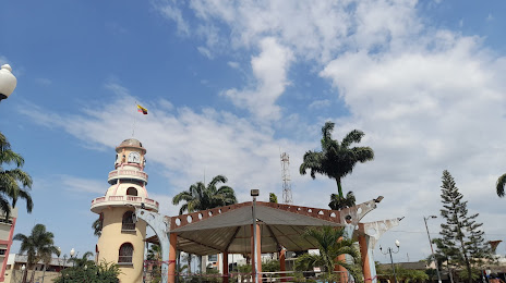
Huaquillas on the map, Ecuador
Where is located Huaquillas
Exact location — Huaquillas, El Oro, Ecuador, marked on the map with a red marker.
Coordinates
Huaquillas, Ecuador coordinates in decimal format: latitude — -3.4763823, longitude — -80.2225448. When converted to degrees, minutes, seconds Huaquillas has the following coordinates: -3°28′34.98 north latitude and -80°13′21.16 east longitude.
Population
Huaquillas, El Oro, Ecuador, according to our data the population is — 39,757 residents, which is about 0.2% of the total population of the country (Ecuador).
Comparison of the population on the graph:
Exact time
Time zone for this location Huaquillas — UTC -5 America/Guayaquil. Exact time — monday, 4 april 2024 year, 09 h. 44 minutes.
Sunrise and sunset
Huaquillas, sunrise and sunset data for a date — monday 29.04.2024.
| Sunrise | Sunset | Day (duration) |
|---|---|---|
| 06:20 -0 minutes | 18:15 -0 minutes | 11 h. 54 minutes. -0 minutes |
You can control the scale of the map using the auxiliary tools to find out exactly where it is located Huaquillas. When you change the scale of the map, the width of the ruler also changes (in kilometers and miles).
Nearby cities
The largest cities that are located nearby:
- Tumbes
 (Peru) — 24 km
 - Santiago — 109 km
- Loja — 126 km
- Guayaquil — 148 km
- Cuenca — 149 km
- Milagro — 164 km
- Sullana (Peru) — 166 km
- Talara (Peru) — 168 km
- Piura (Peru) — 196 km
- Riobamba — 265 km
- Portoviejo — 269 km
- Manta — 283 km
- Quevedo — 284 km
- Ambato — 304 km
- Chiclayo (Peru) — 367 km
- Santo Domingo — 375 km
- Cajamarca (Peru) — 449 km
- Ibarra — 483 km
- Trujillo (Peru) — 529 km
Distance to neighboring capitals:
- Bogota
 (Colombia) — 1128 km
 - Nuestra Señora de La Paz
 (Bolivia) — 1959 km
 - Caracas
 (Venezuela) — 2142 km
 - Santiago
 (Chile) — 3478 km
Attractions
Distance to the capital
Distance to the capital (Quito) is about — 415 km.