
 Manuel María Caballero
Santa Cruz Department
Pozo del Tigre
Motacucito
Colquiri
Inquisivi
Provincia de Andrés Ibáñez
Yacuíba
Tarija
Manuel María Caballero
Santa Cruz Department
Pozo del Tigre
Motacucito
Colquiri
Inquisivi
Provincia de Andrés Ibáñez
Yacuíba
Tarija
Cathedral of Saint Francis on the map, Potosi, Bolivia
Photo
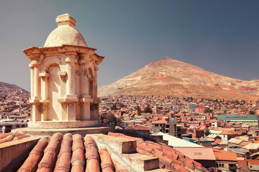
Where is located Cathedral of Saint Francis
Cathedral of Saint Francis — local attraction, which is located at Nogales, Villa Imperial de Potosí, Bolivia and belongs to the category — catholic cathedral. Average visitor rating for this place — 4.5 (according to 104 ratings, information from open sources and relevant for 2022).
Exact location — Cathedral of Saint Francis, marked on the map with a red marker.
You can get directions to Cathedral of Saint Francis on the map from your location.
What else is interesting in Potosi? You can see all the sights if you go to the city page.
Coordinates
Cathedral of Saint Francis, Bolivia coordinates in decimal format: latitude — -19.591220971590825, longitude — -65.75293457554142. When converted to degrees, minutes, seconds Cathedral of Saint Francis has the following coordinates: -19°35′28.4 north latitude and -65°45′10.56 east longitude.
Nearby cities
The largest cities that are located nearby:
- Sucre — 80 km
- Oruro — 228 km
- Tarija — 241 km
- Cochabamba — 246 km
- Santa Cruz de la Sierra — 346 km
- Calama
 (Chile) — 454 km
 - Iquique (Chile) — 461 km
- Arica (Chile) — 493 km
- Tacna
 (Peru) — 503 km
 - San Salvador de Jujuy
 (Argentina) — 512 km
 - Salta (Argentina) — 577 km
- Fist (Peru) — 613 km
- Juliaca (Peru) — 648 km
- Antofagasta (Chile) — 652 km
- Arequipa (Peru) — 706 km
- San Miguel de Tucuman (Argentina) — 802 km
- Santiago del Estero (Argentina) — 920 km
- Cusco (Peru) — 944 km
- Copiapó (Chile) — 972 km
Distance to the capital
Distance to the capital (Nuestra Señora de La Paz) is about — 427 km.