
 Bel-Ha
San Jose El Alto
El Porvenir
Nueva Palestina
Santa Lucía
Chemax
La Morita
Temoac
Zacualpan
Bel-Ha
San Jose El Alto
El Porvenir
Nueva Palestina
Santa Lucía
Chemax
La Morita
Temoac
Zacualpan
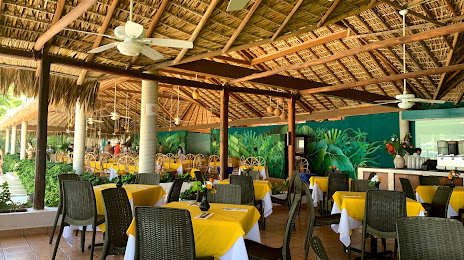
Coconuts Beach Club (Club de Playa Cocos) on the map, Puerto Escondido, Mexico
Photo
Where is located Coconuts Beach Club (Club de Playa Cocos)
Coconuts Beach Club (Club de Playa Cocos) — local attraction, which is located at Bacocho, 71983 Puerto Escondido, Oaxaca, Mexico and belongs to the category — swim club. Average visitor rating for this place — 4.4 (according to 342 ratings, information from open sources and relevant for 2022).
Exact location — Coconuts Beach Club (Club de Playa Cocos), marked on the map with a red marker.
You can get directions to Coconuts Beach Club (Club de Playa Cocos) on the map from your location.
What else is interesting in Puerto Escondido? You can see all the sights if you go to the city page.
Coordinates
Coconuts Beach Club (Club de Playa Cocos), Mexico coordinates in decimal format: latitude — 15.864292948138356, longitude — -97.08760527559471. When converted to degrees, minutes, seconds Coconuts Beach Club (Club de Playa Cocos) has the following coordinates: 15°51′51.45 north latitude and -97°5′15.38 east longitude.
Nearby cities
The largest cities that are located nearby:
- Oaxaca — 137 km
- Tehuacán — 290 km
- Chilpancingo — 317 km
- Acapulco — 317 km
- Orizaba — 330 km
- Córdoba — 334 km
- Minatitlán — 354 km
- Puebla — 371 km
- Coatzacoalcos — 372 km
- Iguala — 377 km
- Cuautla — 381 km
- Jiutepec — 400 km
- Cuernavaca — 406 km
- Xalapa — 407 km
- Chalco de Díaz Covarrubias — 421 km
- Ixtapaluca — 425 km
- Tuxtla Gutiérrez — 431 km
- Ciudad Nezahualcóyotl — 439 km
- Chimalhuacan — 441 km
Distance to the capital
Distance to the capital (Mexico City) is about — 452 km.