
 Puerto de la Duquesa
La Serna de Iguña
Pumalverde
Puentenansa
La Iglesia
Casar de Periedo
Fuengirola
Renedo de Piélagos
Villabanez
Puerto de la Duquesa
La Serna de Iguña
Pumalverde
Puentenansa
La Iglesia
Casar de Periedo
Fuengirola
Renedo de Piélagos
Villabanez
Paseo Del Vino on the map, Cangas del Narcea, Spain
Photo
Where is located Paseo Del Vino
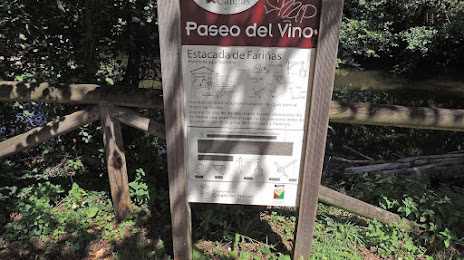
Paseo Del Vino — local attraction, which is located at Río, Naviego, Asturias, Spain and belongs to the category — city park. Average visitor rating for this place — 4.3 (according to 31 rating, information from open sources and relevant for 2022).
Exact location — Paseo Del Vino, marked on the map with a red marker.
You can get directions to Paseo Del Vino on the map from your location.
What else is interesting in Cangas del Narcea? You can see all the sights if you go to the city page.
Coordinates
Paseo Del Vino, Spain coordinates in decimal format: latitude — 43.16803236628552, longitude — -6.543647174968504. When converted to degrees, minutes, seconds Paseo Del Vino has the following coordinates: 43°10′4.92 north latitude and -6°32′37.13 east longitude.
Nearby cities
The largest cities that are located nearby:
- Oviedo — 60 km
- Gijón — 81 km
- León — 102 km
- Ourense — 142 km
- A Coruña — 151 km
- Vigo — 206 km
- Santander — 222 km
- Valladolid — 226 km
- Braga
 (Portugal) — 238 km
 - Burgos — 251 km
- Salamanca — 255 km
- Porto (Portugal) — 283 km
- Bilbao — 291 km
- Vitoria-Gasteiz — 315 km
- Logroño — 344 km
- Coimbra (Portugal) — 364 km
- San Sebastián — 368 km
- Alcobendas — 381 km
- Alcorcón — 388 km
Distance to the capital
Distance to the capital (Madrid) is about — 386 km.