
 La Ensenada
Obero
Cuilapa
Laguna de Montebello
Uaxactun
Melchor de Mencos
Petetan
El Subin
Patanatic
La Ensenada
Obero
Cuilapa
Laguna de Montebello
Uaxactun
Melchor de Mencos
Petetan
El Subin
Patanatic
Cuevas de San Miguel on the map, Totonicapan, Guatemala
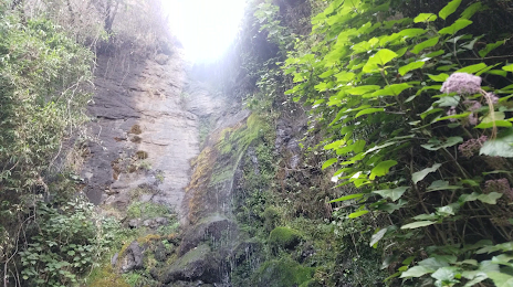
Photo
Where is located Cuevas de San Miguel
Cuevas de San Miguel — local attraction, which is located at Unnamed Road, Guatemala and belongs to the category — national forest. Average visitor rating for this place — 4.2 (according to 6 ratings, information from open sources and relevant for 2022).
Exact location — Cuevas de San Miguel, marked on the map with a red marker.
You can get directions to Cuevas de San Miguel on the map from your location.
What else is interesting in Totonicapan? You can see all the sights if you go to the city page.
Coordinates
Cuevas de San Miguel, Guatemala coordinates in decimal format: latitude — 14.899236033045895, longitude — -91.34589627560673. When converted to degrees, minutes, seconds Cuevas de San Miguel has the following coordinates: 14°53′57.25 north latitude and -91°20′45.23 east longitude.
Nearby cities
The largest cities that are located nearby:
- Quetzaltenango — 19 km
- San Juan Sacatepéquez — 80 km
- Escuintla — 92 km
- Villa Nueva — 93 km
- Tapachula
 (Mexico) — 96 km
 - Villa Canales — 103 km
- Santa Ana
 (El Salvador) — 219 km
 - San Cristóbal de las Casas (Mexico) — 242 km
- Santa Tecla (El Salvador) — 261 km
- Apopa (El Salvador) — 264 km
- Mejicanos (El Salvador) — 265 km
- San Salvador (El Salvador) — 267 km
- Soyapango (El Salvador) — 274 km
- Tuxtla Gutiérrez (Mexico) — 274 km
- San Pedro Sula
 (Honduras) — 360 km
 - Choloma (Honduras) — 372 km
- San Miguel (El Salvador) — 377 km
- Villahermosa (Mexico) — 378 km
- El Progreso (Honduras) — 383 km
Distance to the capital
Distance to the capital (Guatemala City) is about — 93 km.