
 Puerto de la Duquesa
La Serna de Iguña
Pumalverde
Puentenansa
La Iglesia
Casar de Periedo
Fuengirola
Renedo de Piélagos
Villabanez
Puerto de la Duquesa
La Serna de Iguña
Pumalverde
Puentenansa
La Iglesia
Casar de Periedo
Fuengirola
Renedo de Piélagos
Villabanez
Archaeological - natural site of Santomé on the map, Ourense, Spain
Photo
Where is located Archaeological - natural site of Santomé
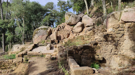
Archaeological - natural site of Santomé — local attraction, which is located at Santo Tomé, 8, 32960 Ourense, Province of Ourense, Spain and belongs to the category — archaeological museum. Average visitor rating for this place — 4.5 (according to 182 ratings, information from open sources and relevant for 2022).
Exact location — Archaeological - natural site of Santomé, marked on the map with a red marker.
You can get directions to Archaeological - natural site of Santomé on the map from your location.
What else is interesting in Ourense? You can see all the sights if you go to the city page.
Coordinates
Archaeological - natural site of Santomé, Spain coordinates in decimal format: latitude — 42.347448196905596, longitude — -7.830207274994703. When converted to degrees, minutes, seconds Archaeological - natural site of Santomé has the following coordinates: 42°20′50.81 north latitude and -7°49′48.75 east longitude.
Nearby cities
The largest cities that are located nearby:
- Vigo — 71 km
- Braga
 (Portugal) — 99 km
 - A Coruña — 122 km
- Porto (Portugal) — 145 km
- León — 189 km
- Oviedo — 198 km
- Gijón — 221 km
- Salamanca — 238 km
- Coimbra (Portugal) — 240 km
- Valladolid — 270 km
- Burgos — 341 km
- Santander — 348 km
- Badajoz — 390 km
- Móstoles — 404 km
- Alcorcón — 405 km
- Alcobendas — 407 km
- Bilbao — 410 km
- Leganés — 410 km
- Fuenlabrada — 410 km
Distance to the capital
Distance to the capital (Madrid) is about — 406 km.