
 Puerto de la Duquesa
La Serna de Iguña
Pumalverde
Puentenansa
La Iglesia
Casar de Periedo
Fuengirola
Renedo de Piélagos
Villabanez
Puerto de la Duquesa
La Serna de Iguña
Pumalverde
Puentenansa
La Iglesia
Casar de Periedo
Fuengirola
Renedo de Piélagos
Villabanez
Playa de Puente Duero on the map, Laguna de Duero, Spain
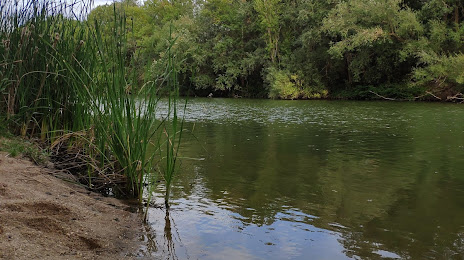
Photo
Where is located Playa de Puente Duero
Playa de Puente Duero — local attraction, which is located at Valladolid and belongs to the category — -. Average visitor rating for this place — 3.3 (according to 14 ratings, information from open sources and relevant for 2022).
Exact location — Playa de Puente Duero, marked on the map with a red marker.
You can get directions to Playa de Puente Duero on the map from your location.
What else is interesting in Laguna de Duero? You can see all the sights if you go to the city page.
Coordinates
Playa de Puente Duero, Spain coordinates in decimal format: latitude — 41.55260779924485, longitude — -4.77637167501967. When converted to degrees, minutes, seconds Playa de Puente Duero has the following coordinates: 41°33′9.39 north latitude and -4°46′34.94 east longitude.
Nearby cities
The largest cities that are located nearby:
- Valladolid — 8 km
- Salamanca — 104 km
- Burgos — 119 km
- León — 132 km
- Alcobendas — 147 km
- Alcorcón — 156 km
- Móstoles — 157 km
- Leganés — 160 km
- Fuenlabrada — 162 km
- Torrejón de Ardoz — 163 km
- Getafe — 164 km
- Alcala de Henares — 167 km
- Logroño — 210 km
- Oviedo — 217 km
- Vitoria-Gasteiz — 217 km
- Santander — 220 km
- Gijón — 228 km
- Bilbao — 235 km
- Ourense — 270 km
Distance to the capital
Distance to the capital (Madrid) is about — 155 km.