
 Józefów nad Wisłą
Gorzyce Wielkie
Rogówek
Sromowce Niżne
Wyszków County
Kruszewo
Jantar
Sady Górne
Nagoszewo
Józefów nad Wisłą
Gorzyce Wielkie
Rogówek
Sromowce Niżne
Wyszków County
Kruszewo
Jantar
Sady Górne
Nagoszewo
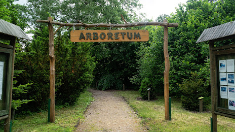
Arboretum Forest District Marcule on the map, Starachowice, Poland
Photo
Where is located Arboretum Forest District Marcule
Arboretum Forest District Marcule — local attraction, which is located at 27-100 Marcule, Poland and belongs to the category — tourist attraction. Average visitor rating for this place — 4.6 (according to 304 ratings, information from open sources and relevant for 2022).
Exact location — Arboretum Forest District Marcule, marked on the map with a red marker.
You can get directions to Arboretum Forest District Marcule on the map from your location.
What else is interesting in Starachowice? You can see all the sights if you go to the city page.
Coordinates
Arboretum Forest District Marcule, Poland coordinates in decimal format: latitude — 51.093942657700666, longitude — 21.214229025304206. When converted to degrees, minutes, seconds Arboretum Forest District Marcule has the following coordinates: 51°5′38.19 north latitude and 21°12′51.22 east longitude.
Nearby cities
The largest cities that are located nearby:
- Kielce — 36 km
- Radom — 41 km
- Lublin — 106 km
- Tarnow — 113 km
- Rzeszow — 128 km
- Kraków — 134 km
- Łódź — 136 km
- Częstochowa — 139 km
- Dabrowa Gornicza — 154 km
- Sosnowiec — 162 km
- Katowice — 168 km
- Bytom — 170 km
- Chorzow — 170 km
- Ruda Slaska — 179 km
- Zabrze — 179 km
- Gliwice — 188 km
- Plock — 190 km
- Bielsko-Biala — 197 km
- Rybnik — 207 km
Distance to the capital
Distance to the capital (Warsaw) is about — 127 km.