
 Józefów nad Wisłą
Gorzyce Wielkie
Rogówek
Sromowce Niżne
Wyszków County
Kruszewo
Jantar
Sady Górne
Nagoszewo
Józefów nad Wisłą
Gorzyce Wielkie
Rogówek
Sromowce Niżne
Wyszków County
Kruszewo
Jantar
Sady Górne
Nagoszewo
Park im. Powstańców Wielkopolskich 1918-1919 on the map, Srem, Poland
Photo
Where is located Park im. Powstańców Wielkopolskich 1918-1919
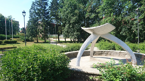
Park im. Powstańców Wielkopolskich 1918-1919 — local attraction, which is located at Poznańska, 63-100 Śrem, Poland and belongs to the category — state park. Average visitor rating for this place — 4.5 (according to 672 ratings, information from open sources and relevant for 2022).
Exact location — Park im. Powstańców Wielkopolskich 1918-1919, marked on the map with a red marker.
You can get directions to Park im. Powstańców Wielkopolskich 1918-1919 on the map from your location.
What else is interesting in Srem? You can see all the sights if you go to the city page.
Coordinates
Park im. Powstańców Wielkopolskich 1918-1919, Poland coordinates in decimal format: latitude — 52.100540622563514, longitude — 17.02828182534128. When converted to degrees, minutes, seconds Park im. Powstańców Wielkopolskich 1918-1919 has the following coordinates: 52°6′1.95 north latitude and 17°1′41.81 east longitude.
Nearby cities
The largest cities that are located nearby:
- Poznań — 36 km
- Kalisz — 81 km
- Zielona Gora — 104 km
- Wrocław — 108 km
- Legnica — 114 km
- Bydgoszcz — 132 km
- Gorzów Wielkopolski — 139 km
- Torun — 147 km
- Wloclawek — 151 km
- Walbrzych — 153 km
- Opole — 169 km
- Łódź — 171 km
- Cottbus
 (Germany) — 187 km
 - Plock — 188 km
- Częstochowa — 204 km
- Szczecin — 220 km
- Gliwice — 230 km
- Zabrze — 232 km
- Bytom — 235 km
Distance to the capital
Distance to the capital (Warsaw) is about — 272 km.