
 Józefów nad Wisłą
Gorzyce Wielkie
Rogówek
Sromowce Niżne
Wyszków County
Kruszewo
Jantar
Sady Górne
Nagoszewo
Józefów nad Wisłą
Gorzyce Wielkie
Rogówek
Sromowce Niżne
Wyszków County
Kruszewo
Jantar
Sady Górne
Nagoszewo
Muzeum Kresów w Lubaczowie on the map, Lubaczow, Poland
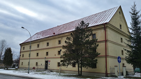
Photo
Where is located Muzeum Kresów w Lubaczowie
Muzeum Kresów w Lubaczowie — local attraction, which is located at Jana III Sobieskiego 4, 37-600 Lubaczów, Poland and belongs to the category — local history museum. Average visitor rating for this place — 4.7 (according to 153 ratings, information from open sources and relevant for 2022).
Exact location — Muzeum Kresów w Lubaczowie, marked on the map with a red marker.
You can get directions to Muzeum Kresów w Lubaczowie on the map from your location.
What else is interesting in Lubaczow? You can see all the sights if you go to the city page.
Coordinates
Muzeum Kresów w Lubaczowie, Poland coordinates in decimal format: latitude — 50.153405644947675, longitude — 23.12819312527012. When converted to degrees, minutes, seconds Muzeum Kresów w Lubaczowie has the following coordinates: 50°9′12.26 north latitude and 23°7′41.5 east longitude.
Nearby cities
The largest cities that are located nearby:
- Rzeszow — 81 km
- Lublin — 127 km
- Tarnow — 153 km
- Uzhhorod
 (Ukraine) — 180 km
 - Kielce — 191 km
- Radom — 194 km
- Košice
 (Slovakia) — 209 km
 - Brest
 (Belarus) — 219 km
 - Rivne (Ukraine) — 225 km
- Kraków — 226 km
- Satu Mare
 (Romania) — 262 km
 - Nyíregyháza
 (Hungary) — 265 km
 - Baia Mare (Romania) — 277 km
- Dabrowa Gornicza — 278 km
- Sosnowiec — 284 km
- Miskolc (Hungary) — 287 km
- Częstochowa — 289 km
- Katowice — 290 km
- Chernivtsi (Ukraine) — 292 km
Distance to the capital
Distance to the capital (Warsaw) is about — 274 km.