
 Józefów nad Wisłą
Gorzyce Wielkie
Rogówek
Sromowce Niżne
Wyszków County
Kruszewo
Jantar
Sady Górne
Nagoszewo
Józefów nad Wisłą
Gorzyce Wielkie
Rogówek
Sromowce Niżne
Wyszków County
Kruszewo
Jantar
Sady Górne
Nagoszewo
Jezioro Dobromierskie on the map, Strzegom, Poland
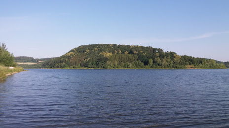
Photo
Where is located Jezioro Dobromierskie
Jezioro Dobromierskie — local attraction, which is located at no data and belongs to the category — -. Average visitor rating for this place — 4.6 (according to 140 ratings, information from open sources and relevant for 2022).
Exact location — Jezioro Dobromierskie, marked on the map with a red marker.
You can get directions to Jezioro Dobromierskie on the map from your location.
What else is interesting in Strzegom? You can see all the sights if you go to the city page.
Coordinates
Jezioro Dobromierskie, Poland coordinates in decimal format: latitude — 50.898357891553985, longitude — 16.24183270758281. When converted to degrees, minutes, seconds Jezioro Dobromierskie has the following coordinates: 50°53′54.09 north latitude and 16°14′30.6 east longitude.
Nearby cities
The largest cities that are located nearby:
- Walbrzych — 20 km
- Legnica — 30 km
- Wrocław — 50 km
- Opole — 114 km
- Zielona Gora — 122 km
- Kalisz — 148 km
- Cottbus
 (Germany) — 164 km
 - Olomouc
 (Czech Republic) — 164 km
 - Poznań — 164 km
- Prague (Czech Republic) — 167 km
- Gliwice — 180 km
- Dresden (Germany) — 182 km
- Rybnik — 182 km
- Ostrava (Czech Republic) — 186 km
- Zabrze — 186 km
- Bytom — 193 km
- Ruda Slaska — 193 km
- Częstochowa — 194 km
- Brno (Czech Republic) — 196 km
Distance to the capital
Distance to the capital (Warsaw) is about — 361 km.