
 Józefów nad Wisłą
Gorzyce Wielkie
Rogówek
Sromowce Niżne
Wyszków County
Kruszewo
Jantar
Sady Górne
Nagoszewo
Józefów nad Wisłą
Gorzyce Wielkie
Rogówek
Sromowce Niżne
Wyszków County
Kruszewo
Jantar
Sady Górne
Nagoszewo
Półwysep Kal on the map, Węgorzewo, Poland
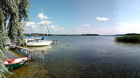
Photo
Where is located Półwysep Kal
Półwysep Kal — local attraction, which is located at no data and belongs to the category — -. Average visitor rating for this place — 4.6 (according to 9 ratings, information from open sources and relevant for 2022).
Exact location — półwysep Kal, marked on the map with a red marker.
You can get directions to Półwysep Kal on the map from your location.
What else is interesting in Węgorzewo? You can see all the sights if you go to the city page.
Coordinates
półwysep Kal, Poland coordinates in decimal format: latitude — 54.17323810165796, longitude — 21.74040661543764. When converted to degrees, minutes, seconds półwysep Kal has the following coordinates: 54°10′23.66 north latitude and 21°44′25.46 east longitude.
Nearby cities
The largest cities that are located nearby:
- Olsztyn — 95 km
- Kaliningrad
 (Russia) — 96 km
 - Elblag — 151 km
- Bialystok — 152 km
- Kaunas
 (Lithuania) — 157 km
 - Klaipėda (Lithuania) — 169 km
- Gdańsk — 200 km
- Gdynia — 209 km
- Šiauliai (Lithuania) — 214 km
- Plock — 230 km
- Vilnius (Lithuania) — 232 km
- Panevėžys (Lithuania) — 234 km
- Torun — 248 km
- Wloclawek — 249 km
- Brest
 (Belarus) — 270 km
 - Bydgoszcz — 275 km
- Baranovichi (Belarus) — 308 km
- Łódź — 313 km
- Radom — 313 km
Distance to the capital
Distance to the capital (Warsaw) is about — 222 km.