
 Józefów nad Wisłą
Gorzyce Wielkie
Rogówek
Sromowce Niżne
Wyszków County
Kruszewo
Jantar
Sady Górne
Nagoszewo
Józefów nad Wisłą
Gorzyce Wielkie
Rogówek
Sromowce Niżne
Wyszków County
Kruszewo
Jantar
Sady Górne
Nagoszewo
Narew National Park on the map, Łapy, Poland
Photo
Where is located Narew National Park
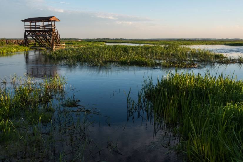
Narew National Park — local attraction, which is located at Kurowo 10, 18-204, Poland and belongs to the category — national park. Average visitor rating for this place — 4.6 (according to 1142 ratings, information from open sources and relevant for 2022).
Exact location — Narew National Park, marked on the map with a red marker.
You can get directions to Narew National Park on the map from your location.
What else is interesting in Łapy? You can see all the sights if you go to the city page.
Coordinates
Narew National Park, Poland coordinates in decimal format: latitude — 53.07273617341879, longitude — 22.868550425377563. When converted to degrees, minutes, seconds Narew National Park has the following coordinates: 53°4′21.85 north latitude and 22°52′6.78 east longitude.
Nearby cities
The largest cities that are located nearby:
- Bialystok — 24 km
- Brest
 (Belarus) — 114 km
 - Olsztyn — 180 km
- Lublin — 194 km
- Baranovichi (Belarus) — 208 km
- Radom — 213 km
- Plock — 219 km
- Kaunas
 (Lithuania) — 221 km
 - Pinsk (Belarus) — 237 km
- Vilnius (Lithuania) — 242 km
- Kaliningrad
 (Russia) — 243 km
 - Wloclawek — 259 km
- Elblag — 260 km
- Łódź — 271 km
- Kielce — 283 km
- Torun — 285 km
- Maladzyechna (Belarus) — 294 km
- Gdańsk — 312 km
- Salihorsk (Belarus) — 312 km
Distance to the capital
Distance to the capital (Warsaw) is about — 156 km.