
 Puerto de la Duquesa
La Serna de Iguña
Pumalverde
Puentenansa
La Iglesia
Casar de Periedo
Fuengirola
Renedo de Piélagos
Villabanez
Puerto de la Duquesa
La Serna de Iguña
Pumalverde
Puentenansa
La Iglesia
Casar de Periedo
Fuengirola
Renedo de Piélagos
Villabanez
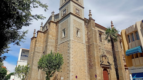
Church of Santiago (Iglesia de Santiago) on the map, Don Benito, Spain
Photo
Where is located Church of Santiago (Iglesia de Santiago)
Church of Santiago (Iglesia de Santiago) — local attraction, which is located at Pl. España, s/n, 06400 Don Benito, Badajoz, Spain and belongs to the category — catholic church. Average visitor rating for this place — 4.7 (according to 72 ratings, information from open sources and relevant for 2022).
Exact location — Church of Santiago (Iglesia de Santiago), marked on the map with a red marker.
You can get directions to Church of Santiago (Iglesia de Santiago) on the map from your location.
What else is interesting in Don Benito? You can see all the sights if you go to the city page.
Coordinates
Church of Santiago (Iglesia de Santiago), Spain coordinates in decimal format: latitude — 38.95428453491977, longitude — -5.861672975098554. When converted to degrees, minutes, seconds Church of Santiago (Iglesia de Santiago) has the following coordinates: 38°57′15.42 north latitude and -5°51′42.02 east longitude.
Nearby cities
The largest cities that are located nearby:
- Badajoz — 96 km
- Córdoba — 151 km
- Dos Hermanas — 184 km
- Huelva — 210 km
- Jaén — 223 km
- Salamanca — 223 km
- Móstoles — 226 km
- Fuenlabrada — 228 km
- Alcorcón — 230 km
- Leganés — 233 km
- Getafe — 234 km
- Jerez — 252 km
- Coimbra
 (Portugal) — 256 km
 - Alcobendas — 256 km
- Torrejón de Ardoz — 261 km
- Alcala de Henares — 270 km
- Cádiz — 271 km
- Málaga — 278 km
- Granada — 280 km
Distance to the capital
Distance to the capital (Madrid) is about — 246 km.