
 Puerto de la Duquesa
La Serna de Iguña
Pumalverde
Puentenansa
La Iglesia
Casar de Periedo
Fuengirola
Renedo de Piélagos
Villabanez
Puerto de la Duquesa
La Serna de Iguña
Pumalverde
Puentenansa
La Iglesia
Casar de Periedo
Fuengirola
Renedo de Piélagos
Villabanez
Ermita de San Saturio on the map, Soria, Spain
Photo
Where is located Ermita de San Saturio
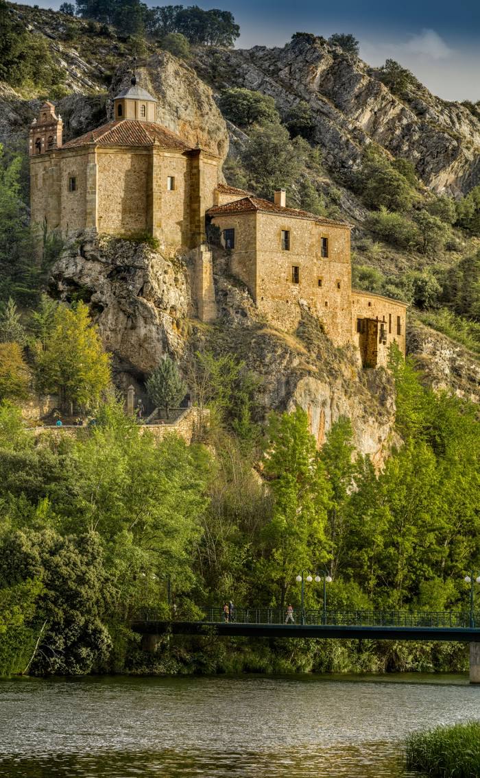
Ermita de San Saturio — local attraction, which is located at S/N, Camino San Saturio, 0, 42002 Soria, Spain and belongs to the category — catholic church. Average visitor rating for this place — 4.7 (according to 1491 rating, information from open sources and relevant for 2022).
Exact location — Ermita de San Saturio, marked on the map with a red marker.
You can get directions to Ermita de San Saturio on the map from your location.
What else is interesting in Soria? You can see all the sights if you go to the city page.
Coordinates
Ermita de San Saturio, Spain coordinates in decimal format: latitude — 41.75340096167865, longitude — -2.457240775013356. When converted to degrees, minutes, seconds Ermita de San Saturio has the following coordinates: 41°45′12.24 north latitude and -2°27′26.07 east longitude.
Nearby cities
The largest cities that are located nearby:
- Logroño — 77 km
- Burgos — 118 km
- Vitoria-Gasteiz — 122 km
- Zaragoza — 132 km
- Pamplona — 134 km
- Alcala de Henares — 160 km
- Alcobendas — 167 km
- Torrejón de Ardoz — 167 km
- Bilbao — 169 km
- San Sebastián — 176 km
- Valladolid — 186 km
- Leganés — 192 km
- Getafe — 193 km
- Alcorcón — 194 km
- Fuenlabrada — 198 km
- Móstoles — 198 km
- Santander — 216 km
- Lleida — 257 km
- León — 268 km
Distance to the capital
Distance to the capital (Madrid) is about — 182 km.