
 Puerto de la Duquesa
La Serna de Iguña
Pumalverde
Puentenansa
La Iglesia
Casar de Periedo
Fuengirola
Renedo de Piélagos
Villabanez
Puerto de la Duquesa
La Serna de Iguña
Pumalverde
Puentenansa
La Iglesia
Casar de Periedo
Fuengirola
Renedo de Piélagos
Villabanez
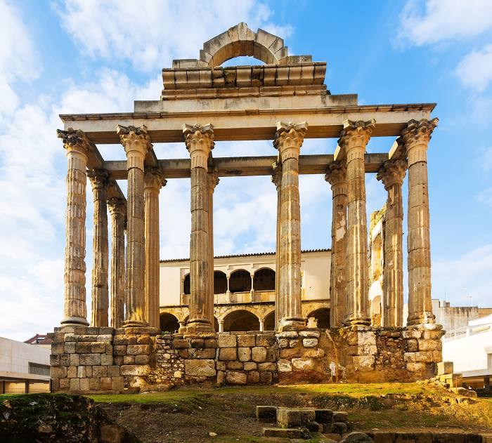
Temple of Diana (Templo de Diana) on the map, Mérida, Spain
Photo
Where is located Temple of Diana (Templo de Diana)
Temple of Diana (Templo de Diana) — local attraction, which is located at Oficinas del Consorcio, C. Sta. Julia, 5, 06800 Mérida, Badajoz, Spain and belongs to the category — historical landmark. Average visitor rating for this place — 4.6 (according to 8187 ratings, information from open sources and relevant for 2022).
Exact location — Temple of Diana (Templo de Diana), marked on the map with a red marker.
You can get directions to Temple of Diana (Templo de Diana) on the map from your location.
What else is interesting in Mérida? You can see all the sights if you go to the city page.
Coordinates
Temple of Diana (Templo de Diana), Spain coordinates in decimal format: latitude — 38.91645661489376, longitude — -6.344402575099667. When converted to degrees, minutes, seconds Temple of Diana (Templo de Diana) has the following coordinates: 38°54′59.24 north latitude and -6°20′39.85 east longitude.
Nearby cities
The largest cities that are located nearby:
- Badajoz — 54 km
- Córdoba — 178 km
- Dos Hermanas — 184 km
- Huelva — 190 km
- Coimbra
 (Portugal) — 225 km
 - Salamanca — 234 km
- Lisbon (Portugal) — 242 km
- Jerez — 247 km
- Amadora (Portugal) — 249 km
- Queluz (Portugal) — 251 km
- Jaén — 257 km
- Móstoles — 261 km
- Fuenlabrada — 263 km
- Cádiz — 264 km
- Alcorcón — 265 km
- Leganés — 268 km
- Getafe — 269 km
- Alcobendas — 290 km
- Torrejón de Ardoz — 296 km
Distance to the capital
Distance to the capital (Madrid) is about — 281 km.