
 Puerto de la Duquesa
La Serna de Iguña
Pumalverde
Puentenansa
La Iglesia
Casar de Periedo
Fuengirola
Renedo de Piélagos
Villabanez
Puerto de la Duquesa
La Serna de Iguña
Pumalverde
Puentenansa
La Iglesia
Casar de Periedo
Fuengirola
Renedo de Piélagos
Villabanez
Parque Oromana on the map, Alcalá de Guadaira, Spain
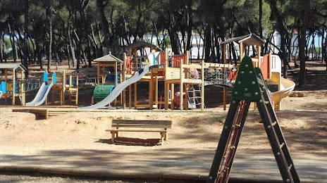
Photo
Where is located Parque Oromana
Parque Oromana — local attraction, which is located at Calle Camino de Oromana, 2A, 41500 Alcalá de Guadaíra, Sevilla, Spain and belongs to the category — park. Average visitor rating for this place — 4.6 (according to 1013 ratings, information from open sources and relevant for 2022).
Exact location — Parque Oromana, marked on the map with a red marker.
You can get directions to Parque Oromana on the map from your location.
What else is interesting in Alcalá de Guadaira? You can see all the sights if you go to the city page.
Coordinates
Parque Oromana, Spain coordinates in decimal format: latitude — 37.32872228925451, longitude — -5.843504475145728. When converted to degrees, minutes, seconds Parque Oromana has the following coordinates: 37°19′43.4 north latitude and -5°50′36.62 east longitude.
Nearby cities
The largest cities that are located nearby:
- Dos Hermanas — 9 km
- Jerez — 77 km
- Huelva — 97 km
- Cádiz — 98 km
- Córdoba — 111 km
- Marbella — 125 km
- Algeciras — 137 km
- Málaga — 141 km
- Tangier
 (Morocco) — 175 km
 - Jaén — 186 km
- Badajoz — 196 km
- Granada — 198 km
- Tetouan (Morocco) — 201 km
- Almería — 304 km
- Lisbon
 (Portugal) — 323 km
 - Taounate (Morocco) — 329 km
- Amadora (Portugal) — 331 km
- Queluz (Portugal) — 334 km
- Kenitra (Morocco) — 348 km
Distance to the capital
Distance to the capital (Madrid) is about — 390 km.