 Clearlake
Atlantic City
Petaluma
Oceanside
Big Rapids
Larkspur
Sonoma
Sebastopol
Pikesville
Minden City
Alpine
New Baltimore
Pontiac
Rochester
Cass City
Roseville
Northville
Bad Axe
Fenton
Clearlake
Atlantic City
Petaluma
Oceanside
Big Rapids
Larkspur
Sonoma
Sebastopol
Pikesville
Minden City
Alpine
New Baltimore
Pontiac
Rochester
Cass City
Roseville
Northville
Bad Axe
Fenton
Mentor on the map, United States
Where is located Mentor
Exact location — Mentor, Lake County, Ohio, United States, marked on the map with a red marker.
Coordinates
Mentor, United States coordinates in decimal format: latitude — 41.6661573, longitude — -81.339552. When converted to degrees, minutes, seconds Mentor has the following coordinates: 41°39′58.17 north latitude and -81°20′22.39 east longitude.
Population
Mentor, Lake County, Ohio, United States, according to our data the population is — 49,726 residents, which is about 0% of the total population of the country (United States).
Comparison of the population on the graph:
Exact time
Time zone for this location Mentor — UTC -4 America/New_York. Exact time — friday, 4 april 2024 year, 02 h. 12 minutes.
Sunrise and sunset
Mentor, sunrise and sunset data for a date — friday 26.04.2024.
| Sunrise | Sunset | Day (duration) |
|---|---|---|
| 06:30 -2 minutes | 20:15 +1 minute | 13 h. 48 minutes. +3 minutes |
You can control the scale of the map using the auxiliary tools to find out exactly where it is located Mentor. When you change the scale of the map, the width of the ruler also changes (in kilometers and miles).
Nearby cities
The largest cities that are located nearby:
- Cleveland — 35 km
- Aurora — 39 km
- Akron — 66 km
- London
 (Canada) — 146 km
 - Windsor (Canada) — 156 km
- Detroit — 158 km
- Warren — 166 km
- Sterling Heights — 171 km
- Pittsburgh — 176 km
- Toledo — 183 km
- Cambridge (Canada) — 205 km
- Kitchener (Canada) — 205 km
- Ann Arbor — 208 km
- Waterloo (Canada) — 209 km
- Hamilton (Canada) — 212 km
- Burlington (Canada) — 221 km
- Guelph (Canada) — 225 km
- Columbus — 235 km
- Saint Catharines (Canada) — 236 km
Distance to neighboring capitals:
- Ottawa (Canada) — 617 km
- Belmopan
 (Belize) — 2806 km
 - Mexico City
 (Mexico) — 2990 km
 - Nuuk
 (Greenland) — 3136 km
 - Guatemala City
 (Guatemala) — 3137 km
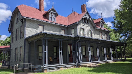
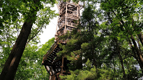
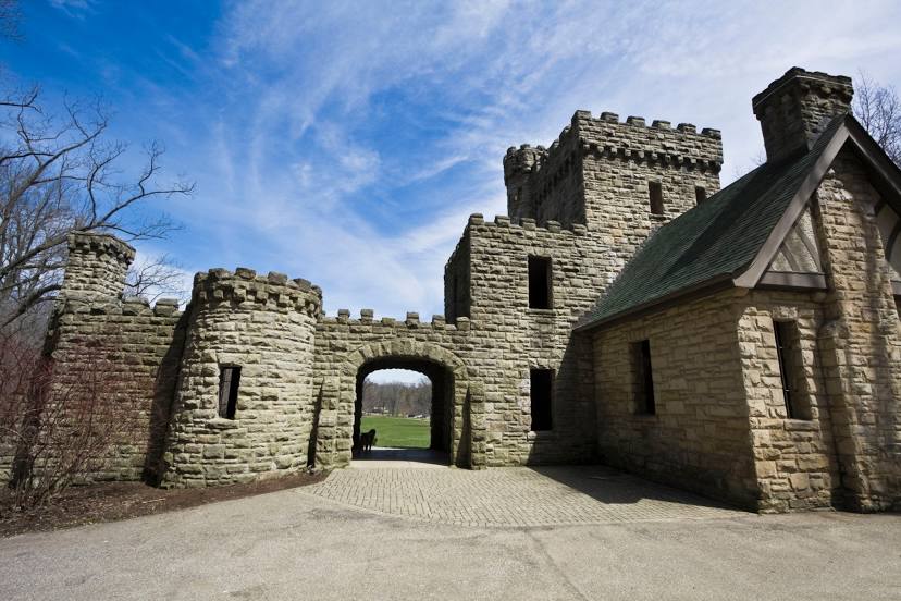
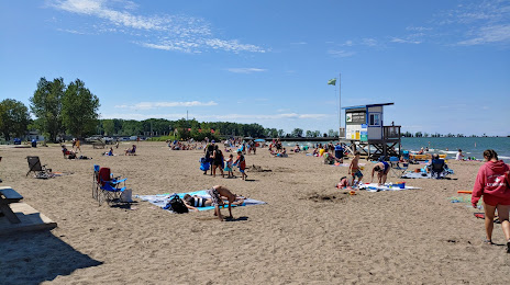
Attractions


Distance to the capital
Distance to the capital (Washington) is about — 477 km.