
 Montmorillon
Mainvilliers
Loches
Vervins
Borne
Montmélian
Megève
Bayeux
La Clusaz
Céret
Augny
Beynost
Bidart
Villemomble
Cordes-sur-Ciel
Le Coudray
La Charité-sur-Loire
Malataverne
Étupes
Montmorillon
Mainvilliers
Loches
Vervins
Borne
Montmélian
Megève
Bayeux
La Clusaz
Céret
Augny
Beynost
Bidart
Villemomble
Cordes-sur-Ciel
Le Coudray
La Charité-sur-Loire
Malataverne
Étupes
Pontivy on the map, France
Where is located Pontivy
Exact location — Pontivy, Morbihan, Brittany, France, marked on the map with a red marker.
Coordinates
Pontivy, France coordinates in decimal format: latitude — 48.066152, longitude — -2.967056. When converted to degrees, minutes, seconds Pontivy has the following coordinates: 48°3′58.15 north latitude and -2°58′1.4 east longitude.
Population
Pontivy, Morbihan, Brittany, France, according to our data the population is — 13,789 residents, which is about 0% of the total population of the country (France).
Comparison of the population on the graph:
Exact time
Time zone for this location Pontivy — UTC +2 Europe/Paris. Exact time — monday, 5 may 2024 year, 21 h. 50 minutes.
Sunrise and sunset
Pontivy, sunrise and sunset data for a date — monday 13.05.2024.
| Sunrise | Sunset | Day (duration) |
|---|---|---|
| 06:38 -1 minute | 21:37 +1 minute | 15 h. 0 minutes. +2 minutes |
You can control the scale of the map using the auxiliary tools to find out exactly where it is located Pontivy. When you change the scale of the map, the width of the ruler also changes (in kilometers and miles).
Nearby cities
The largest cities that are located nearby:
- Rennes — 95 km
- Brest — 117 km
- Nantes — 142 km
- Angers — 191 km
- Caen — 225 km
- Le Mans — 234 km
- Le Havre — 271 km
- Tours — 283 km
- Exeter
 (United Kingdom) — 296 km
 - Bournemouth (United Kingdom) — 303 km
- Rouen — 330 km
- Portsmouth (United Kingdom) — 332 km
- Southampton (United Kingdom) — 333 km
- Orléans — 362 km
- Bristol (Great Britain) — 376 km
- Eastbourne (United Kingdom) — 376 km
- Crawley (United Kingdom) — 388 km
- Boulogne-Billancourt — 388 km
- Swindon (United Kingdom) — 394 km
Distance to neighboring capitals:
- London (United Kingdom) — 434 km
- Brussels
 (Belgium) — 613 km
 - Andorra la Vella
 (Andorra) — 711 km
 - Amsterdam
 (Netherlands) — 736 km
 - Bern
 (Switzerland) — 791 km
 - Madrid
 (Spain) — 853 km
 - Vaduz
 (Liechtenstein) — 941 km
 - Lisbon
 (Portugal) — 1152 km
 - Berlin
 (Germany) — 1261 km
 - Prague
 (Czech Republic) — 1285 km
 - Copenhagen
 (Denmark) — 1357 km
 - Rome
 (Italy) — 1393 km
 - Vienna
 (Austria) — 1432 km
 - Warsaw
 (Poland) — 1762 km
 - Nicosia
 — 3304 km
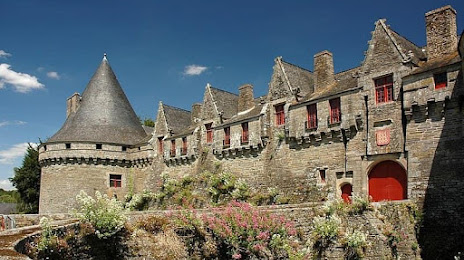
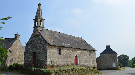
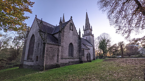
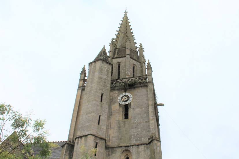
Attractions

Distance to the capital
Distance to the capital (Paris) is about — 402 km.