
 Raon-l'Étape
Saint-Aubin-de-Blaye
Fontenay-le-Comte
Bussy-Saint-Georges
Lagrasse
Port-de-Bouc
Montignac
Gujan-Mestras
Callen
Annecy-le-Vieux
Bois-Colombes
Carrières-sous-Poissy
Châteauneuf-les-Martigues
Bagnols-sur-Cèze
Solliès-Pont
Mons-en-Barœul
Villeneuve-le-Roi
Boissy-Saint-Léger
Bourgueil
Raon-l'Étape
Saint-Aubin-de-Blaye
Fontenay-le-Comte
Bussy-Saint-Georges
Lagrasse
Port-de-Bouc
Montignac
Gujan-Mestras
Callen
Annecy-le-Vieux
Bois-Colombes
Carrières-sous-Poissy
Châteauneuf-les-Martigues
Bagnols-sur-Cèze
Solliès-Pont
Mons-en-Barœul
Villeneuve-le-Roi
Boissy-Saint-Léger
Bourgueil
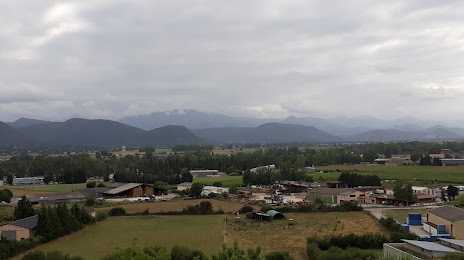
Saint-Gaudens on the map, France
Where is located Saint-Gaudens
Exact location — Saint-Gaudens, Haute-Garonne, Midi-Pyrénées, France, marked on the map with a red marker.
Coordinates
Saint-Gaudens, France coordinates in decimal format: latitude — 43.106895, longitude — 0.723763. When converted to degrees, minutes, seconds Saint-Gaudens has the following coordinates: 43°6′24.82 north latitude and 0°43′25.55 east longitude.
Population
Saint-Gaudens, Haute-Garonne, Midi-Pyrénées, France, according to our data the population is — 10,698 residents, which is about 0% of the total population of the country (France).
Comparison of the population on the graph:
Exact time
Time zone for this location Saint-Gaudens — UTC +2 Europe/Paris. Exact time — thursday, 5 may 2024 year, 02 h. 06 minutes.
Sunrise and sunset
Saint-Gaudens, sunrise and sunset data for a date — thursday 23.05.2024.
| Sunrise | Sunset | Day (duration) |
|---|---|---|
| 06:29 -1 minute | 21:18 +1 minute | 14 h. 48 minutes. +2 minutes |
You can control the scale of the map using the auxiliary tools to find out exactly where it is located Saint-Gaudens. When you change the scale of the map, the width of the ruler also changes (in kilometers and miles).
Nearby cities
The largest cities that are located nearby:
- Toulouse — 80 km
- Lleida
 (Spain) — 165 km
 - Perpignan — 182 km
- Pamplona (Spain) — 195 km
- Terrassa (Spain) — 201 km
- Sabadell (Spain) — 207 km
- Zaragoza (Spain) — 209 km
- Bordeaux — 217 km
- San Sebastián (Spain) — 219 km
- Santa Coloma de Gramenet (Spain) — 221 km
- Badalona (Spain) — 223 km
- Tarragona (Spain) — 224 km
- Mataró (Spain) — 224 km
- L'Hospitalet de Llobregat (Spain) — 224 km
- Montpellier — 258 km
- Logroño (Spain) — 268 km
- Vitoria-Gasteiz (Spain) — 277 km
- Bilbao (Spain) — 295 km
- Nimes — 301 km
Distance to neighboring capitals:
- Andorra la Vella
 (Andorra) — 93 km
 - Madrid (Spain) — 474 km
- Bern
 (Switzerland) — 679 km
 - Vaduz
 (Liechtenstein) — 823 km
 - Brussels
 (Belgium) — 904 km
 - London
 (United Kingdom) — 937 km
 - Lisbon
 (Portugal) — 961 km
 - Rome
 (Italy) — 974 km
 - Amsterdam
 (Netherlands) — 1076 km
 - Prague
 (Czech Republic) — 1300 km
 - Vienna
 (Austria) — 1339 km
 - Berlin
 (Germany) — 1408 km
 - Copenhagen
 (Denmark) — 1635 km
 - Warsaw
 (Poland) — 1817 km
 - Nicosia
 — 2930 km
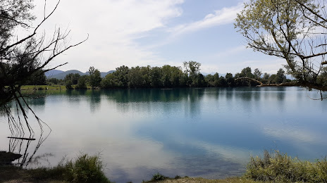
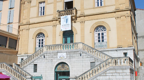
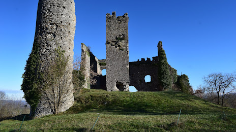
Attractions

Distance to the capital
Distance to the capital (Paris) is about — 652 km.