
 Pomiechówek
Zabki
Zakroczym
Wiązowna
Celestynów
Józefów
Zielonka
Mikolajki
Stopnica
Bielsk Podlaski
Karczew
Lipno
Jaworzno
Wladyslawowo
Trzemeszno
Świątniki Górne
Cedynia
Skwierzyna
Krynica Morska
Pomiechówek
Zabki
Zakroczym
Wiązowna
Celestynów
Józefów
Zielonka
Mikolajki
Stopnica
Bielsk Podlaski
Karczew
Lipno
Jaworzno
Wladyslawowo
Trzemeszno
Świątniki Górne
Cedynia
Skwierzyna
Krynica Morska
Szamotuly on the map, Poland
Where is located Szamotuly
Exact location — Szamotuly, Szamotuły County, Greater Poland Voivodeship, Poland, marked on the map with a red marker.
Coordinates
Szamotuly, Poland coordinates in decimal format: latitude — 52.6116547, longitude — 16.5779047. When converted to degrees, minutes, seconds Szamotuly has the following coordinates: 52°36′41.96 north latitude and 16°34′40.46 east longitude.
Population
Szamotuly, Szamotuły County, Greater Poland Voivodeship, Poland, according to our data the population is — 18,588 residents, which is about 0% of the total population of the country (Poland).
Comparison of the population on the graph:
Exact time
Time zone for this location Szamotuly — UTC +2 Europe/Warsaw. Exact time — wednesday, 5 may 2024 year, 22 h. 11 minutes.
Sunrise and sunset
Szamotuly, sunrise and sunset data for a date — wednesday 8.05.2024.
| Sunrise | Sunset | Day (duration) |
|---|---|---|
| 05:12 -1 minute | 20:28 +2 minutes | 15 h. 18 minutes. +3 minutes |
You can control the scale of the map using the auxiliary tools to find out exactly where it is located Szamotuly. When you change the scale of the map, the width of the ruler also changes (in kilometers and miles).
Nearby cities
The largest cities that are located nearby:
- Poznań — 33 km
- Gorzów Wielkopolski — 91 km
- Zielona Gora — 105 km
- Bydgoszcz — 111 km
- Kalisz — 139 km
- Torun — 142 km
- Legnica — 158 km
- Szczecin — 161 km
- Wloclawek — 167 km
- Wrocław — 169 km
- Koszalin — 177 km
- Cottbus
 (Germany) — 180 km
 - Walbrzych — 203 km
- Plock — 210 km
- Berlin (Germany) — 214 km
- Berlin (Germany) — 215 km
- Łódź — 218 km
- Opole — 234 km
- Gdańsk — 234 km
Distance to neighboring capitals:
- Berlin (Germany) — 215 km
- Prague
 (Czech Republic) — 319 km
 - Copenhagen
 (Denmark) — 429 km
 - Vienna
 (Austria) — 490 km
 - Bratislava
 (Slovakia) — 498 km
 - Budapest
 (Hungary) — 595 km
 - Vilnius
 (Lithuania) — 618 km
 - Rīga
 (Latvia) — 682 km
 - Minsk
 (Belarus) — 744 km
 - Amsterdam
 (Netherlands) — 791 km
 - Bern
 (Switzerland) — 908 km
 - Belgrade
 (Serbia) — 915 km
 - Helsinki
 (Finland) — 984 km
 - Kyiv
 (Ukraine) — 993 km
 - Paris
 (France) — 1083 km
 - Bucharest
 (Romania) — 1147 km
 - Moscow
 (Russia) — 1407 km
 - Tbilisi
 (Georgia) — 2430 km
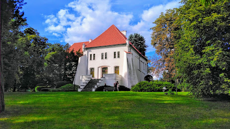
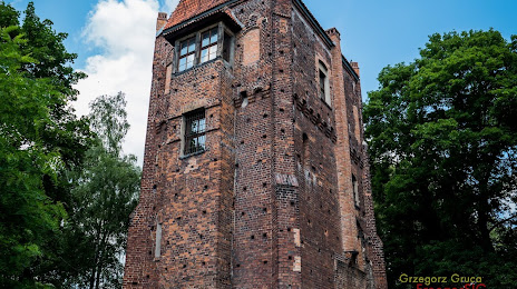
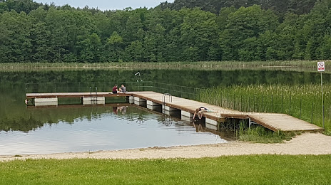
Attractions
Distance to the capital
Distance to the capital (Warsaw) is about — 304 km.