Val de Cans International Airport — São Pedro
Val de Cans International Airport — Coroados
Val de Cans International Airport — Itabaiana
Val de Cans International Airport — Brumadinho
Val de Cans International Airport — Chaves
Val de Cans International Airport — Vale do Paraíso
Val de Cans International Airport — Flores
Val de Cans International Airport — Sobrália
Val de Cans International Airport — José de Freitas
Val de Cans International Airport — Mata de São João
Val de Cans International Airport — Lages
Val de Cans International Airport — Itaúna
Val de Cans International Airport — Taiobeiras
Val de Cans International Airport — Santa Vitória do Palmar
Val de Cans International Airport — Ubirajara
Val de Cans International Airport — São Pedro
Val de Cans International Airport — Feliciano
Val de Cans International Airport — Pouso Redondo
Val de Cans International Airport — Iacanga
Belém
Ananindeua
Acará
Imperatriz
Porto Franco
Araguaína
Nova Olinda
Colinas do Tocantins
Miranorte
Paraíso do Tocantins
Gurupi
Cariri do Tocantins
Porangatu
Uruaçu
Rialma
Nerópolis
Goiânia Airport
Goiânia
Hidrolândia
Morrinhos
Itumbiara
Araporã
Centralina
Prata
Planura
Barretos
Colina
Bebedouro
Taquaral
Taiúva
Santa Ernestina
Dobrada
Matão
Ibaté
São Carlos
Itirapina
São Paulo
Rio Claro
Santa Gertrudes
Iracemápolis
Piracicaba
Saltinho
Tietê
Tietê
Cerquilho
Alambari
Itapetininga
Itapetininga
Apiaí
Bocaiúva do Sul
Colombo
Curitiba
Val de Cans International Airport — São Pedro
Val de Cans International Airport — Coroados
Val de Cans International Airport — Itabaiana
Val de Cans International Airport — Brumadinho
Val de Cans International Airport — Chaves
Val de Cans International Airport — Vale do Paraíso
Val de Cans International Airport — Flores
Val de Cans International Airport — Sobrália
Val de Cans International Airport — José de Freitas
Val de Cans International Airport — Mata de São João
Val de Cans International Airport — Lages
Val de Cans International Airport — Itaúna
Val de Cans International Airport — Taiobeiras
Val de Cans International Airport — Santa Vitória do Palmar
Val de Cans International Airport — Ubirajara
Val de Cans International Airport — São Pedro
Val de Cans International Airport — Feliciano
Val de Cans International Airport — Pouso Redondo
Val de Cans International Airport — Iacanga
Belém
Ananindeua
Acará
Imperatriz
Porto Franco
Araguaína
Nova Olinda
Colinas do Tocantins
Miranorte
Paraíso do Tocantins
Gurupi
Cariri do Tocantins
Porangatu
Uruaçu
Rialma
Nerópolis
Goiânia Airport
Goiânia
Hidrolândia
Morrinhos
Itumbiara
Araporã
Centralina
Prata
Planura
Barretos
Colina
Bebedouro
Taquaral
Taiúva
Santa Ernestina
Dobrada
Matão
Ibaté
São Carlos
Itirapina
São Paulo
Rio Claro
Santa Gertrudes
Iracemápolis
Piracicaba
Saltinho
Tietê
Tietê
Cerquilho
Alambari
Itapetininga
Itapetininga
Apiaí
Bocaiúva do Sul
Colombo
Curitiba
See how the reverse distance goes.
São Bento do Sul — Val de Cans International AirportVal de Cans International Airport — São Bento do Sul distance, route on the map
Distance by car
Distance between Val de Cans International Airport, Pará, Brazil and São Bento do Sul, State of Santa Catarina, Brazil by car is — km, or miles. To travel this distance by car, you need minute, or h.
Route on the map, driving directions
Car route Val de Cans International Airport — São Bento do Sul was created automatically. The road on the map is shown as a blue line. By moving the markers, you can create a new route through the points you need.
Passing cities through which the car route passes: Belém, Belém, Ananindeua, Acará, Imperatriz, Porto Franco, Araguaína, Nova Olinda, Colinas do Tocantins, Miranorte, Paraíso do Tocantins, Gurupi, Cariri do Tocantins, Porangatu, Uruaçu, Rialma, Nerópolis, Goiânia Airport, Goiânia, Hidrolândia, Morrinhos, Itumbiara, Araporã, Centralina, Prata, Planura, Barretos, Colina, Bebedouro, Taquaral, Taiúva, Santa Ernestina, Dobrada, Matão, Ibaté, São Carlos, Itirapina, São Paulo, Rio Claro, Santa Gertrudes, Iracemápolis, Piracicaba, Saltinho, Tietê, Tietê, Cerquilho, Alambari, Itapetininga, Itapetininga, Apiaí, Bocaiúva do Sul, Colombo, Curitiba.
Distance by plane
If you decide to take a trip Val de Cans International Airport São Bento do Sul by plane, then you have to fly the distance — 2774 km or 1720 miles. It is marked on the map with a gray line (between two points in a straight line).
Flight time
Estimated flight time Val de Cans International Airport São Bento do Sul by plane at cruising speed 750 km / h will be — 3 h. and 41 min.
Direction of movement
Brazil, Val de Cans International Airport — right-hand traffic. Brazil, São Bento do Sul — right-hand traffic.
Difference in time
Val de Cans International Airport and São Bento do Sul are in the same time zone. Between them there is no time difference (UTC -3 America/Belem).
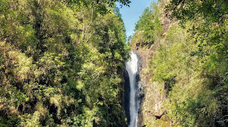
Interesting Facts
Information on alternative ways to get to your destination.
The length of this distance is about 6.9% of the total length of the equator.
The cost of travel
Calculate the cost of the trip yourself using the fuel consumption calculator, changing the data in the table.