
 Kije
Kamieniec Ząbkowicki
Makow Mazowiecki
Czersk
Wiśniowa
Zlotoryja
Ozimek
Byczyna
Goraj
Czluchow
Kosakowo
Krosniewice
Adelnau
Sokołów Podlaski
Konstantynów Łódzki
Goworowo
Konstancin-Jeziorna
Baranowo
Poddębice
Kije
Kamieniec Ząbkowicki
Makow Mazowiecki
Czersk
Wiśniowa
Zlotoryja
Ozimek
Byczyna
Goraj
Czluchow
Kosakowo
Krosniewice
Adelnau
Sokołów Podlaski
Konstantynów Łódzki
Goworowo
Konstancin-Jeziorna
Baranowo
Poddębice
Sokolka on the map, Poland
Where is located Sokolka
Exact location — Sokolka, Sokółka County, Podlaskie Voivodeship, Poland, marked on the map with a red marker.
Coordinates
Sokolka, Poland coordinates in decimal format: latitude — 53.4061597, longitude — 23.5030235. When converted to degrees, minutes, seconds Sokolka has the following coordinates: 53°24′22.17 north latitude and 23°30′10.88 east longitude.
Population
Sokolka, Sokółka County, Podlaskie Voivodeship, Poland, according to our data the population is — 19,079 residents, which is about 0.1% of the total population of the country (Poland).
Comparison of the population on the graph:
Exact time
Time zone for this location Sokolka — UTC +2 Europe/Warsaw. Exact time — monday, 4 april 2024 year, 08 h. 08 minutes.
Sunrise and sunset
Sokolka, sunrise and sunset data for a date — monday 29.04.2024.
| Sunrise | Sunset | Day (duration) |
|---|---|---|
| 04:58 -2 minutes | 19:47 +1 minute | 14 h. 48 minutes. +3 minutes |
You can control the scale of the map using the auxiliary tools to find out exactly where it is located Sokolka. When you change the scale of the map, the width of the ruler also changes (in kilometers and miles).
Nearby cities
The largest cities that are located nearby:
- Bialystok — 38 km
- Brest
 (Belarus) — 146 km
 - Kaunas
 (Lithuania) — 167 km
 - Baranovichi (Belarus) — 169 km
- Vilnius (Lithuania) — 182 km
- Olsztyn — 202 km
- Pinsk (Belarus) — 225 km
- Maladzyechna (Belarus) — 238 km
- Kaliningrad
 (Russia) — 240 km
 - Lublin — 247 km
- Panevėžys (Lithuania) — 263 km
- Minsk (Belarus) — 270 km
- Plock — 272 km
- Radom — 275 km
- Elblag — 278 km
- Salihorsk (Belarus) — 278 km
- Šiauliai (Lithuania) — 280 km
- Klaipėda (Lithuania) — 293 km
- Wloclawek — 309 km
Distance to neighboring capitals:
- Vilnius (Lithuania) — 184 km
- Minsk (Belarus) — 273 km
- Rīga
 (Latvia) — 396 km
 - Kyiv
 (Ukraine) — 583 km
 - Berlin
 (Germany) — 683 km
 - Prague
 (Czech Republic) — 725 km
 - Budapest
 (Hungary) — 729 km
 - Bratislava
 (Slovakia) — 737 km
 - Copenhagen
 (Denmark) — 748 km
 - Helsinki
 (Finland) — 758 km
 - Vienna
 (Austria) — 764 km
 - Moscow (Russia) — 945 km
- Belgrade
 (Serbia) — 984 km
 - Bucharest
 (Romania) — 1016 km
 - Amsterdam
 (Netherlands) — 1251 km
 - Bern
 (Switzerland) — 1346 km
 - Paris
 (France) — 1554 km
 - Tbilisi
 (Georgia) — 2046 km
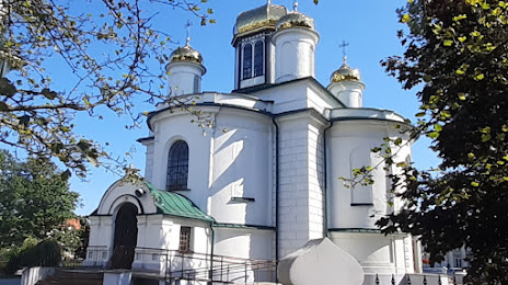
Attractions
Distance to the capital
Distance to the capital (Warsaw) is about — 212 km.