
 Los Cristianos
Feria
Elx
Olot
Magaña
Paterna
Novelda
Getafe
Borriana
Durango
Orcoyen
Huete
Torrejón de Ardoz
Alcaraz
Cartagena
Blanca
Valdilecha
Noáin
Arnedo
Los Cristianos
Feria
Elx
Olot
Magaña
Paterna
Novelda
Getafe
Borriana
Durango
Orcoyen
Huete
Torrejón de Ardoz
Alcaraz
Cartagena
Blanca
Valdilecha
Noáin
Arnedo
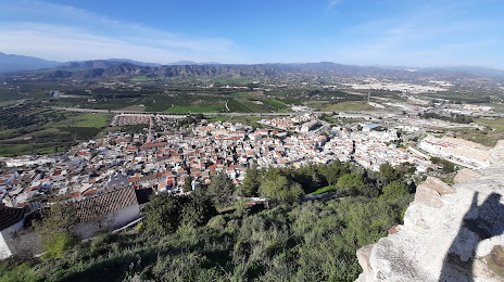
Cártama on the map, Spain
Where is located Cártama
Exact location — Cártama, Málaga, Andalucía, Spain, marked on the map with a red marker.
Coordinates
Cártama, Spain coordinates in decimal format: latitude — 36.7121567, longitude — -4.629873. When converted to degrees, minutes, seconds Cártama has the following coordinates: 36°42′43.76 north latitude and -4°37′47.54 east longitude.
Population
Cártama, Málaga, Andalucía, Spain, according to our data the population is — 15,604 residents, which is about 0% of the total population of the country (Spain).
Comparison of the population on the graph:
Exact time
Time zone for this location Cártama — UTC +2 Europe/Madrid. Exact time — thursday, 5 may 2024 year, 13 h. 22 minutes.
Sunrise and sunset
Cártama, sunrise and sunset data for a date — thursday 9.05.2024.
| Sunrise | Sunset | Day (duration) |
|---|---|---|
| 07:18 -1 minute | 21:11 +1 minute | 13 h. 54 minutes. +2 minutes |
You can control the scale of the map using the auxiliary tools to find out exactly where it is located Cártama. When you change the scale of the map, the width of the ruler also changes (in kilometers and miles).
Nearby cities
The largest cities that are located nearby:
- Málaga — 14 km
- Marbella — 32 km
- Algeciras — 97 km
- Granada — 104 km
- Dos Hermanas — 130 km
- Córdoba — 131 km
- Jerez — 133 km
- Jaén — 139 km
- Tetouan
 (Morocco) — 143 km
 - Cádiz — 149 km
- Tangier (Morocco) — 151 km
- Almería — 192 km
- Huelva — 213 km
- Nador (Morocco) — 230 km
- Taounate (Morocco) — 241 km
- Taza (Morocco) — 282 km
- Badajoz — 313 km
- Meknes (Morocco) — 323 km
- Kenitra (Morocco) — 326 km
Distance to neighboring capitals:
- Rabat (Morocco) — 365 km
- Lisbon
 (Portugal) — 455 km
 - Andorra la Vella
 (Andorra) — 832 km
 - Paris
 (France) — 1465 km
 - Paris (France) — 1465 km
Attractions


Distance to the capital
Distance to the capital (Madrid) is about — 420 km.