
 Leczna
Hrubieszow
Grodziec
Dąbrówka
Stare Juchy
Kotuń
Bogdaniec
Deszczno
Dobiegniew
Nadarzyn
Kampinos
Skała
Łapy
Dziwnow
Leoncin
Węgorzewo
Wieczfnia Kościelna
Czernichów
Czarna
Leczna
Hrubieszow
Grodziec
Dąbrówka
Stare Juchy
Kotuń
Bogdaniec
Deszczno
Dobiegniew
Nadarzyn
Kampinos
Skała
Łapy
Dziwnow
Leoncin
Węgorzewo
Wieczfnia Kościelna
Czernichów
Czarna
Jarocin on the map, Poland
Where is located Jarocin
Exact location — Jarocin, Jarocin County, Greater Poland Voivodeship, Poland, marked on the map with a red marker.
Coordinates
Jarocin, Poland coordinates in decimal format: latitude — 51.9724492, longitude — 17.5019414. When converted to degrees, minutes, seconds Jarocin has the following coordinates: 51°58′20.82 north latitude and 17°30′6.99 east longitude.
Population
Jarocin, Jarocin County, Greater Poland Voivodeship, Poland, according to our data the population is — 25,665 residents, which is about 0.1% of the total population of the country (Poland).
Comparison of the population on the graph:
Exact time
Time zone for this location Jarocin — UTC +2 Europe/Warsaw. Exact time — sunday, 5 may 2024 year, 04 h. 37 minutes.
Sunrise and sunset
Jarocin, sunrise and sunset data for a date — sunday 12.05.2024.
| Sunrise | Sunset | Day (duration) |
|---|---|---|
| 05:04 -1 minute | 20:28 +2 minutes | 15 h. 24 minutes. +3 minutes |
You can control the scale of the map using the auxiliary tools to find out exactly where it is located Jarocin. When you change the scale of the map, the width of the ruler also changes (in kilometers and miles).
Nearby cities
The largest cities that are located nearby:
- Kalisz — 46 km
- Poznań — 62 km
- Wrocław — 101 km
- Legnica — 126 km
- Wloclawek — 129 km
- Bydgoszcz — 132 km
- Łódź — 136 km
- Zielona Gora — 136 km
- Torun — 136 km
- Opole — 146 km
- Walbrzych — 157 km
- Plock — 161 km
- Częstochowa — 171 km
- Gorzów Wielkopolski — 173 km
- Gliwice — 203 km
- Zabrze — 203 km
- Bytom — 205 km
- Chorzow — 212 km
- Ruda Slaska — 213 km
Distance to neighboring capitals:
- Berlin
 (Germany) — 286 km
 - Prague
 (Czech Republic) — 301 km
 - Vienna
 (Austria) — 426 km
 - Bratislava
 (Slovakia) — 427 km
 - Budapest
 (Hungary) — 510 km
 - Copenhagen
 (Denmark) — 524 km
 - Vilnius
 (Lithuania) — 598 km
 - Rīga
 (Latvia) — 698 km
 - Minsk
 (Belarus) — 707 km
 - Belgrade
 (Serbia) — 828 km
 - Amsterdam
 (Netherlands) — 860 km
 - Bern
 (Switzerland) — 916 km
 - Kyiv
 (Ukraine) — 922 km
 - Helsinki
 (Finland) — 1021 km
 - Bucharest
 (Romania) — 1052 km
 - Paris
 (France) — 1126 km
 - Moscow
 (Russia) — 1379 km
 - Tbilisi
 (Georgia) — 2348 km
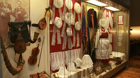
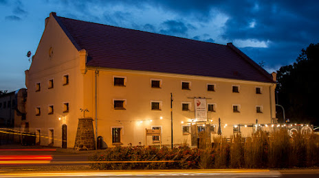
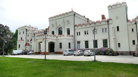
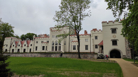
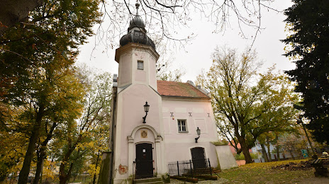
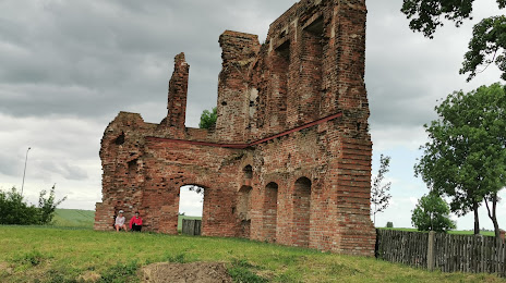
Attractions
Distance to the capital
Distance to the capital (Warsaw) is about — 242 km.