
 Estella
Las Rozas
Castalla
Zarautz
Olaberria
Llorenç del Penedès
Santa María de Cayón
Venta de Baños
Calera de León
Vega de San Mateo
Villalobos
San Andrés
Teruel
Peñalver
Cortes de Aragón
Yuncos
Cristóbal
Tordera
Sangüesa
Estella
Las Rozas
Castalla
Zarautz
Olaberria
Llorenç del Penedès
Santa María de Cayón
Venta de Baños
Calera de León
Vega de San Mateo
Villalobos
San Andrés
Teruel
Peñalver
Cortes de Aragón
Yuncos
Cristóbal
Tordera
Sangüesa
Cocentaina on the map, Spain
Where is located Cocentaina
Exact location — Cocentaina, Alicante, Valencian Community, Spain, marked on the map with a red marker.
Coordinates
Cocentaina, Spain coordinates in decimal format: latitude — 38.7451583, longitude — -0.4396248. When converted to degrees, minutes, seconds Cocentaina has the following coordinates: 38°44′42.57 north latitude and -0°26′22.65 east longitude.
Population
Cocentaina, Alicante, Valencian Community, Spain, according to our data the population is — 12,404 residents, which is about 0% of the total population of the country (Spain).
Comparison of the population on the graph:
Exact time
Time zone for this location Cocentaina — UTC +2 Europe/Madrid. Exact time — saturday, 5 may 2024 year, 23 h. 32 minutes.
Sunrise and sunset
Cocentaina, sunrise and sunset data for a date — saturday 11.05.2024.
| Sunrise | Sunset | Day (duration) |
|---|---|---|
| 06:55 -1 minute | 21:00 +1 minute | 14 h. 6 minutes. +2 minutes |
You can control the scale of the map using the auxiliary tools to find out exactly where it is located Cocentaina. When you change the scale of the map, the width of the ruler also changes (in kilometers and miles).
Nearby cities
The largest cities that are located nearby:
- Valencia — 80 km
- Murcia — 103 km
- Albacete — 125 km
- Cartagena — 133 km
- Almería — 277 km
- Palma — 279 km
- Tarragona — 298 km
- Jaén — 311 km
- Alcala de Henares — 312 km
- Torrejón de Ardoz — 318 km
- Zaragoza — 323 km
- Chlef
 (Algeria) — 326 km
 - Getafe — 327 km
- Granada — 328 km
- Lleida — 329 km
- Leganés — 331 km
- Fuenlabrada — 331 km
- Alcobendas — 334 km
- Alcorcón — 336 km
Distance to neighboring capitals:
- Andorra la Vella
 (Andorra) — 450 km
 - Lisbon
 (Portugal) — 755 km
 - Rabat
 (Morocco) — 782 km
 - Paris
 (France) — 1147 km
 - Paris (France) — 1147 km
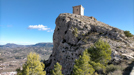
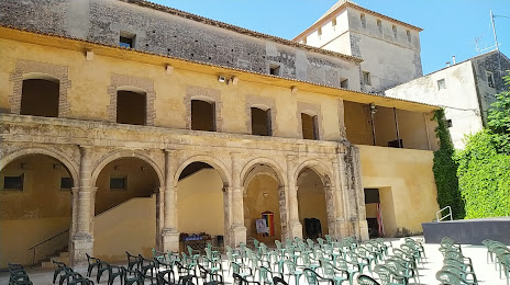
Attractions

Distance to the capital
Distance to the capital (Madrid) is about — 336 km.