Marki — Stopnica
Marki — Knyszyn
Marki — Grodziec
Marki — Osie
Marki — Piotrkowice
Marki — Banie Mazurskie
Marki — Barszcze
Marki — Żywiec
Marki — Głuchów
Marki — Dębowa Kłoda
Marki — Buczek
Marki — Łagów
Marki — Przerośl
Marki — Bronkowice
Marki — Wijewo
Marki — Mała Komorza
Marki — Górki Wielkie
Marki — Sucha
Marki — Gózd
Kobyłka
Czarna
Słupno
Dybów-Kolonia
Dąbrówka Polska
Trojany
Lucynów
Wyszków County
Turzyn
Brańszczyk
Knurowiec
Nagoszewka Pierwsza
Nagoszewo
Ostrow Mazowiecka
Śniadowo
Mikołajki
Lomza
Piątnica
Kisielnica
Murawy
Kołaki-Wietrzychowo
Stawiski
Kownacin
Szczuczyn
Włosty
Kobylin
Nowa Wieś Ełcka
Elk
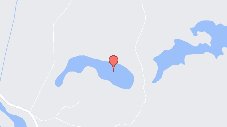
Marki — Olecko distance, route on the map
Distance by car
Distance between Marki, Masovian Voivodeship, Poland and Olecko, Warmian-Masurian Voivodeship, Poland by car is — km, or miles. To travel this distance by car, you need minute, or h.
Route on the map, driving directions
Car route Marki — Olecko was created automatically. The road on the map is shown as a blue line. By moving the markers, you can create a new route through the points you need.
Passing cities through which the car route passes: Zielonka, Kobyłka, Czarna, Słupno, Dybów-Kolonia, Dąbrówka Polska, Trojany, Lucynów, Wyszków County, Turzyn, Brańszczyk, Knurowiec, Nagoszewka Pierwsza, Nagoszewo, Ostrow Mazowiecka, Śniadowo, Mikołajki, Lomza, Piątnica, Kisielnica, Murawy, Kołaki-Wietrzychowo, Stawiski, Kownacin, Szczuczyn, Włosty, Kobylin, Nowa Wieś Ełcka, Elk.
Distance by plane
If you decide to take a trip Marki Olecko by plane, then you have to fly the distance — 212 km or 131 miles. It is marked on the map with a gray line (between two points in a straight line).
Flight time
Estimated flight time Marki Olecko by plane at cruising speed 750 km / h will be — 16 min.
Direction of movement
Poland, Marki — right-hand traffic. Poland, Olecko — right-hand traffic.
Difference in time
Marki and Olecko are in the same time zone. Between them there is no time difference (UTC +2 Europe/Warsaw).
Interesting Facts
Information on alternative ways to get to your destination.
The length of this distance is about 0.5% of the total length of the equator.
The percentage of the population is clearly shown in the graph:
Marki — 23,177, Olecko — 15,923 residents (less by 7,254).
The cost of travel
Calculate the cost of the trip yourself using the fuel consumption calculator, changing the data in the table.