Ciudad Río Bravo — Jiquipilas
Ciudad Río Bravo — Frontera Comalapa
Ciudad Río Bravo — Cacalchén
Ciudad Río Bravo — Salvación
Ciudad Río Bravo — Tarimoro
Ciudad Río Bravo — Lerma
Ciudad Río Bravo — Jerez de García Salinas
Ciudad Río Bravo — Chacala
Ciudad Río Bravo — Vallarta
Ciudad Río Bravo — La Palmilla
Ciudad Río Bravo — Los Herrera
Ciudad Río Bravo — Tepetzintla
Ciudad Río Bravo — Cumpas
Ciudad Río Bravo — Valdeflores
Ciudad Río Bravo — Kanasín
Ciudad Río Bravo — La y Griega
Ciudad Río Bravo — El Palmar
Ciudad Río Bravo — Cherán
Ciudad Río Bravo — Tapilula
General Lucio Blanco International Airport
Independence
Alfredo V. Bonfil
Águila Azteca
San Fernando
Ejido Guadalupe Victoria
Soto la Marina
Aldama
Villa Manuel
Cuauhtemoc
Esteros
Altamira
Miramar
Tampico
Ciudad Madero
Ciudad Madero
Tampico
Tampico
Primero de Mayo
Ciudad Cuauhtémoc
Pueblo Viejo
Tampico Alto
Ozuluama de Mascareñas
Pedernales
Naranjos
Naranjos
Tamiahua
Tuxpan
Tuxpan
Tihuatlán
La Isla
Venustiano Carranza Municipality, Puebla
Xicotepec
Huauchinango
Ahuazotepec
Agua Zarca
Chignahuapan
Tlaxco
San Pedro Ecatepec
Tetla
Apizaco
Yauhquemecan
Santa Cruz Tlaxcala
Apetatitlán
Chiautempan
Teolocholco
Zacatelco
San Pablo del Monte
Real del Monte
Tepatlaxco de Hidalgo
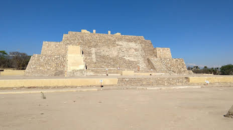
Ciudad Río Bravo — Tehuacán distance, route on the map
Distance by car
Distance between Ciudad Río Bravo, Tamaulipas, Mexico and Tehuacán, Puebla, Mexico by car is — km, or miles. To travel this distance by car, you need minute, or h.
Route on the map, driving directions
Car route Ciudad Río Bravo — Tehuacán was created automatically. The road on the map is shown as a blue line. By moving the markers, you can create a new route through the points you need.
Passing cities through which the car route passes: Aeropuerto, General Lucio Blanco International Airport, Independence, Alfredo V. Bonfil, Águila Azteca, San Fernando, Ejido Guadalupe Victoria, Soto la Marina, Aldama, Villa Manuel, Cuauhtemoc, Esteros, Altamira, Miramar, Tampico, Ciudad Madero, Ciudad Madero, Tampico, Tampico, Primero de Mayo, Ciudad Cuauhtémoc, Pueblo Viejo, Tampico Alto, Ozuluama de Mascareñas, Pedernales, Naranjos, Naranjos, Tamiahua, Tuxpan, Tuxpan, Tihuatlán, La Isla, Venustiano Carranza Municipality, Puebla, Xicotepec, Huauchinango, Ahuazotepec, Agua Zarca, Chignahuapan, Tlaxco, San Pedro Ecatepec, Tetla, Apizaco, Yauhquemecan, Santa Cruz Tlaxcala, Apetatitlán, Chiautempan, Teolocholco, Zacatelco, San Pablo del Monte, Real del Monte, Tepatlaxco de Hidalgo.
Distance by plane
If you decide to take a trip Ciudad Río Bravo Tehuacán by plane, then you have to fly the distance — 839 km or 520 miles. It is marked on the map with a gray line (between two points in a straight line).
Flight time
Estimated flight time Ciudad Río Bravo Tehuacán by plane at cruising speed 750 km / h will be — 1 h. and 7 min.
Direction of movement
Mexico, Ciudad Río Bravo — right-hand traffic. Mexico, Tehuacán — right-hand traffic.
Difference in time
Ciudad Río Bravo and Tehuacán are in the same time zone. Between them there is no time difference (UTC -6 America/Mexico_City).
Interesting Facts
Information on alternative ways to get to your destination.
The length of this distance is about 2.1% of the total length of the equator.
The cost of travel
Calculate the cost of the trip yourself using the fuel consumption calculator, changing the data in the table.