El Salitre — Tijuana
El Salitre — San Pablo del Monte
El Salitre — Juan Rodríguez Clara
El Salitre — Tanquián de Escobedo
El Salitre — Opodepe
El Salitre — Costa Careyes
El Salitre — Venustiano Carranza
El Salitre — Hunucmá
El Salitre — Tehuacán
El Salitre — Pericos
El Salitre — Creel
El Salitre — Chinameca
El Salitre — Hidalgo
El Salitre — Colonia Leyes de Reforma
El Salitre — Nayarit
El Salitre — Aeropuerto Internacional de Mérida Manuel Crescencio Rejón MID
El Salitre — Ciudad Ayala
El Salitre — San Roberto
El Salitre — Villa de Hidalgo
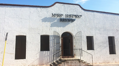
El Salitre — Reynosa distance, route on the map
Distance by car
Distance between El Salitre, Jalisco, Mexico and Reynosa, Tamaulipas, Mexico by car is — km, or miles. To travel this distance by car, you need minute, or h.
Route on the map, driving directions
Car route El Salitre — Reynosa was created automatically. The road on the map is shown as a blue line. By moving the markers, you can create a new route through the points you need.
Distance by plane
If you decide to take a trip El Salitre Reynosa by plane, then you have to fly the distance — 843 km or 523 miles. It is marked on the map with a gray line (between two points in a straight line).
Flight time
Estimated flight time El Salitre Reynosa by plane at cruising speed 750 km / h will be — 1 h. and 7 min.
Direction of movement
Mexico, El Salitre — right-hand traffic. Mexico, Reynosa — right-hand traffic.
Difference in time
El Salitre and Reynosa are in different time zones. The time difference is 1 hour (UTC -6 America/Mexico_City, UTC -5 America/Chicago).
Interesting Facts
Information on alternative ways to get to your destination.
The length of this distance is about 2.1% of the total length of the equator.
The percentage of the population is clearly shown in the graph:
El Salitre — 4,408 (less by 494,262), Reynosa — 498,670 residents.
The cost of travel
Calculate the cost of the trip yourself using the fuel consumption calculator, changing the data in the table.