La Junta — Comalteco
La Junta — Santa María Ipalapa
La Junta — Ciudad Juarez
La Junta — Lagunillas de Muñoz
La Junta — Ciudad Hidalgo
La Junta — New Italy
La Junta — Coquimatlán
La Junta — Coyuca de Benítez
La Junta — Uxmal
La Junta — Zirahuén
La Junta — Chablekal
La Junta — Zamora
La Junta — Guadalupe
La Junta — Finisterre
La Junta — Taray
La Junta — Jesús Carranza
La Junta — San Sebastián Ixcapa
La Junta — Tlatlauquitepec
La Junta — Cerro Azul
Pedernales
Ciudad Cuauhtemoc
Concepción
San Nicolás de Carretas
Satevó Municipality
Valle de Zaragoza
Parral
Parral
Mariano Matamoros
Villa las Nieves
Santa Bárbara
Rodeo
San Juan del Río
Durango
Morcillo
Durango
El Salto
Pueblo Nuevo
Zapote
La Petaca
Copala
Concordia
Villa Unión
El Huajote
El Rosario
Reform
La Concha
Tecuala
Rosamorada
Paso Real del Bejuco
Ruiz
El Capomal
Yago Station
La Guinea
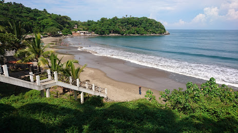
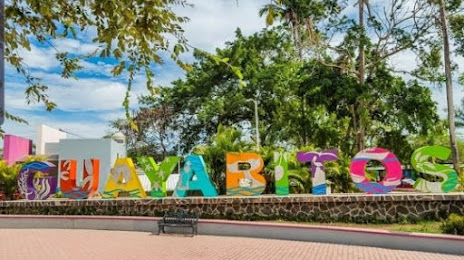
Guayabitos
Tepic
Xalisco
La Junta — Comalteco
La Junta — Santa María Ipalapa
La Junta — Ciudad Juarez
La Junta — Lagunillas de Muñoz
La Junta — Ciudad Hidalgo
La Junta — New Italy
La Junta — Coquimatlán
La Junta — Coyuca de Benítez
La Junta — Uxmal
La Junta — Zirahuén
La Junta — Chablekal
La Junta — Zamora
La Junta — Guadalupe
La Junta — Finisterre
La Junta — Taray
La Junta — Jesús Carranza
La Junta — San Sebastián Ixcapa
La Junta — Tlatlauquitepec
La Junta — Cerro Azul
Pedernales
Ciudad Cuauhtemoc
Concepción
San Nicolás de Carretas
Satevó Municipality
Valle de Zaragoza
Parral
Parral
Mariano Matamoros
Villa las Nieves
Santa Bárbara
Rodeo
San Juan del Río
Durango
Morcillo
Durango
El Salto
Pueblo Nuevo
Zapote
La Petaca
Copala
Concordia
Villa Unión
El Huajote
El Rosario
Reform
La Concha
Tecuala
Rosamorada
Paso Real del Bejuco
Ruiz
El Capomal
Yago Station
La Guinea
Guayabitos
Tepic
Xalisco
La Junta — Compostela distance, route on the map
Distance by car
Distance between La Junta, Chihuahua, Mexico and Compostela, Nayarit, Mexico by car is — km, or miles. To travel this distance by car, you need minute, or h.
Route on the map, driving directions
Car route La Junta — Compostela was created automatically. The road on the map is shown as a blue line. By moving the markers, you can create a new route through the points you need.
Passing cities through which the car route passes: Boquilla y Anexas, Pedernales, Ciudad Cuauhtemoc, Concepción, San Nicolás de Carretas, Satevó Municipality, Valle de Zaragoza, Parral, Parral, Mariano Matamoros, Villa las Nieves, Santa Bárbara, Rodeo, San Juan del Río, Durango, Morcillo, Durango, El Salto, Pueblo Nuevo, Zapote, La Petaca, Copala, Concordia, Villa Unión, El Huajote, El Rosario, Reform, La Concha, Tecuala, Rosamorada, Paso Real del Bejuco, Ruiz, El Capomal, Yago Station, La Guinea, Guayabitos, Tepic, Xalisco.
Distance by plane
If you decide to take a trip La Junta Compostela by plane, then you have to fly the distance — 842 km or 522 miles. It is marked on the map with a gray line (between two points in a straight line).
Flight time
Estimated flight time La Junta Compostela by plane at cruising speed 750 km / h will be — 1 h. and 7 min.
Direction of movement
Mexico, La Junta — right-hand traffic. Mexico, Compostela — right-hand traffic.
Difference in time
La Junta and Compostela are in the same time zone. Between them there is no time difference (UTC -7 America/Mazatlan).
Interesting Facts
Information on alternative ways to get to your destination.
The length of this distance is about 2.1% of the total length of the equator.
The cost of travel
Calculate the cost of the trip yourself using the fuel consumption calculator, changing the data in the table.