Camargo — Sinaloa de Leyva
Camargo — San José Iturbide
Camargo — La Regina
Camargo — La Alberca
Camargo — Hermosillo
Camargo — Mexico
Camargo — El Encinal
Camargo — Oriental
Camargo — Emilio Portes Gil
Camargo — Los Janos
Camargo — San Juan de las Gaviotas
Camargo — Tepatitlan de Morelos
Camargo — Tecámac
Camargo — Paa Mul
Camargo — Mina
Camargo — Buenavista
Camargo — El Tejocote
Camargo — Telchac Pueblo
Camargo — Badiraguato
Delicias
Delicias
Pedro Meoqui
Pedro Meoqui
Bachimba
Chihuahua
Aeropuerto Internacional General Roberto Fierro Villalobos
Chihuahua
Pan American
Chihuahua
Sacramento
El Sauz
Galeana
Galeana Municipality
Nuevo Casas Grandes Municipality
Janos
Douglas
Camargo — Sinaloa de Leyva
Camargo — San José Iturbide
Camargo — La Regina
Camargo — La Alberca
Camargo — Hermosillo
Camargo — Mexico
Camargo — El Encinal
Camargo — Oriental
Camargo — Emilio Portes Gil
Camargo — Los Janos
Camargo — San Juan de las Gaviotas
Camargo — Tepatitlan de Morelos
Camargo — Tecámac
Camargo — Paa Mul
Camargo — Mina
Camargo — Buenavista
Camargo — El Tejocote
Camargo — Telchac Pueblo
Camargo — Badiraguato
Delicias
Delicias
Pedro Meoqui
Pedro Meoqui
Bachimba
Chihuahua
Aeropuerto Internacional General Roberto Fierro Villalobos
Chihuahua
Pan American
Chihuahua
Sacramento
El Sauz
Galeana
Galeana Municipality
Nuevo Casas Grandes Municipality
Janos
Douglas  Agua Prieta
Bisbee
Sierra Vista
Benson
Tucson International Airport
Tucson
Lukeville
General Plutarco Elías Calles
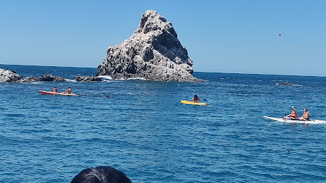
Sonoyta
Agua Prieta
Bisbee
Sierra Vista
Benson
Tucson International Airport
Tucson
Lukeville
General Plutarco Elías Calles
Sonoyta
Camargo — Puerto Peñasco distance, route on the map
Distance by car
Distance between Camargo, Chihuahua, Mexico and Puerto Peñasco, Sonora, Mexico by car is — km, or miles. To travel this distance by car, you need minute, or h.
Route on the map, driving directions
Car route Camargo — Puerto Peñasco was created automatically. The road on the map is shown as a blue line. By moving the markers, you can create a new route through the points you need.
Passing cities through which the car route passes: Saucillo, Delicias, Delicias, Pedro Meoqui, Pedro Meoqui, Bachimba, Chihuahua, Aeropuerto Internacional General Roberto Fierro Villalobos, Chihuahua, Pan American, Chihuahua, Sacramento, El Sauz, Galeana, Galeana Municipality, Nuevo Casas Grandes Municipality, Janos, Douglas (us), Agua Prieta, Bisbee (us), Sierra Vista (us), Benson (us), Tucson International Airport (us), Tucson (us), Lukeville (us), General Plutarco Elías Calles, Sonoyta.
Distance by plane
If you decide to take a trip Camargo Puerto Peñasco by plane, then you have to fly the distance — 905 km or 561 miles. It is marked on the map with a gray line (between two points in a straight line).
Flight time
Estimated flight time Camargo Puerto Peñasco by plane at cruising speed 750 km / h will be — 1 h. and 12 min.
Direction of movement
Mexico, Camargo — right-hand traffic. Mexico, Puerto Peñasco — right-hand traffic.
Difference in time
Camargo and Puerto Peñasco are in the same time zone. Between them there is no time difference (UTC -7 America/Mazatlan).
Interesting Facts
Information on alternative ways to get to your destination.
The length of this distance is about 2.3% of the total length of the equator.
The percentage of the population is clearly shown in the graph:
Camargo — 37,745, Puerto Peñasco — 33,877 residents (less by 3,868).
The cost of travel
Calculate the cost of the trip yourself using the fuel consumption calculator, changing the data in the table.