Atotonilco el Grande — Tarandacuao
Atotonilco el Grande — Cuapiaxtla
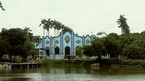
Atotonilco el Grande — Parque temático Villas del Oeste
Atotonilco el Grande — El Salitre
Atotonilco el Grande — Transport
Atotonilco el Grande — Magdalena Tequisistlán
Atotonilco el Grande — Isla Blanca
Atotonilco el Grande — The boat
Atotonilco el Grande — Aeropuerto Internacional General Roberto Fierro Villalobos
Atotonilco el Grande — Chiapa de Corzo
Atotonilco el Grande — Airport Ing. Juan Guillermo Villasana
Atotonilco el Grande — Alamos
Atotonilco el Grande — Abasolo
Atotonilco el Grande — Juan José Ríos
Atotonilco el Grande — Amecameca
Atotonilco el Grande — El Arenal
Atotonilco el Grande — Minatitlán
Atotonilco el Grande — San Pedro de Ures
Atotonilco el Grande — Playa Vicente
San Agustín Metzquititlán
Zacualtipan
Tianguistengo
Molango
Michumitla
Tlanchinol
El Rosario
Huejutla de Reyes
Huejutla de Reyes
Chalma
Platón Sánchez
Tempoal
Tempoal
El Zapotal
Pánuco
Tampico
Tampico
Atotonilco el Grande — Tarandacuao
Atotonilco el Grande — Cuapiaxtla
Atotonilco el Grande — Parque temático Villas del Oeste
Atotonilco el Grande — El Salitre
Atotonilco el Grande — Transport
Atotonilco el Grande — Magdalena Tequisistlán
Atotonilco el Grande — Isla Blanca
Atotonilco el Grande — The boat
Atotonilco el Grande — Aeropuerto Internacional General Roberto Fierro Villalobos
Atotonilco el Grande — Chiapa de Corzo
Atotonilco el Grande — Airport Ing. Juan Guillermo Villasana
Atotonilco el Grande — Alamos
Atotonilco el Grande — Abasolo
Atotonilco el Grande — Juan José Ríos
Atotonilco el Grande — Amecameca
Atotonilco el Grande — El Arenal
Atotonilco el Grande — Minatitlán
Atotonilco el Grande — San Pedro de Ures
Atotonilco el Grande — Playa Vicente
San Agustín Metzquititlán
Zacualtipan
Tianguistengo
Molango
Michumitla
Tlanchinol
El Rosario
Huejutla de Reyes
Huejutla de Reyes
Chalma
Platón Sánchez
Tempoal
Tempoal
El Zapotal
Pánuco
Tampico
Tampico
Atotonilco el Grande — Miramar distance, route on the map
Distance by car
Distance between Atotonilco el Grande, Hidalgo, Mexico and Miramar, Tamaulipas, Mexico by car is — km, or miles. To travel this distance by car, you need minute, or h.
Route on the map, driving directions
Car route Atotonilco el Grande — Miramar was created automatically. The road on the map is shown as a blue line. By moving the markers, you can create a new route through the points you need.
Passing cities through which the car route passes: Atotonilco el Grande, San Agustín Metzquititlán, Zacualtipan, Tianguistengo, Molango, Michumitla, Tlanchinol, El Rosario, Huejutla de Reyes, Huejutla de Reyes, Chalma, Platón Sánchez, Tempoal, Tempoal, El Zapotal, Pánuco, Tampico, Tampico.
Distance by plane
If you decide to take a trip Atotonilco el Grande Miramar by plane, then you have to fly the distance — 243 km or 151 miles. It is marked on the map with a gray line (between two points in a straight line).
Flight time
Estimated flight time Atotonilco el Grande Miramar by plane at cruising speed 750 km / h will be — 19 min.
Direction of movement
Mexico, Atotonilco el Grande — right-hand traffic. Mexico, Miramar — right-hand traffic.
Difference in time
Atotonilco el Grande and Miramar are in the same time zone. Between them there is no time difference (UTC -6 America/Mexico_City).
Interesting Facts
Information on alternative ways to get to your destination.
The length of this distance is about 0.6% of the total length of the equator.
The percentage of the population is clearly shown in the graph:
Atotonilco el Grande — 6,871 (less by 60,818), Miramar — 67,689 residents.
The cost of travel
Calculate the cost of the trip yourself using the fuel consumption calculator, changing the data in the table.